Italiano
 Deutsch
Col Leynir - Valle Orco

It is one of the well-known classic mtb tours to be done in summer. I remember an unsuccessful attempt in July 2020 because of snow, the summit in September of the same year but without the descent from the real road after the Bastalon hut, today September 8, 2023 complete tour even though the departure from an altitude of 2,100 would have avoided the asphalt ascent in the sun.
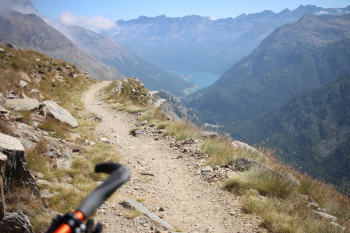
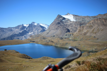
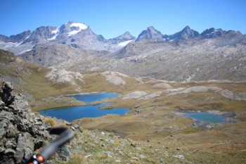
Departure from Lake Serrù at an altitude of 2,200 meters and immediately meet a picturesque streetwalker, see photo. From Colle del Nivolet descent on dirt road near Rifugio Città di Chivasso and then start of climb with Col Leynir signs in 2 hours on foot which is little more than the time required on mtb. You pass an initial steep grassy section and then on level ground you reach an alpine pasture that with a long steep ramp with compact bottom and scattered stones leads to Lake Rosset from which there is a magnificent view: to the right on Gran Paradiso and surroundings, to the left on Basei.
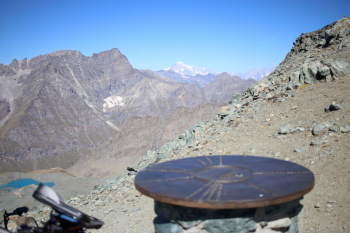
A long midslope leads to the base of a ridge with wide serpentines that are cyclable, but the switchbacks are very narrow. You enter a hollow with final section not cyclable due to large boulders, but it has been resurfaced; in 2020 the passage with mtb on shoulders was uncomfortable. The climb up scree begins, the one on the left we will do downhill, the one on the right is less steep, but halfway up it forces you to put the bike on your back. At the top photo with views of Mont Blanc, the untamed continue to the Taou Blanc.
Descent
Back to Piani del Nivolet along the ascent route, the first section is followed by a steep and landslide slope; then it's a gentle and scenic descent, after the alpine pasture I opted for the variant on Rifugio Savoia. Uphill on asphalt and then downhill variant of Lake Losere, uphill and magnificent views of Lake Ceresole, short, challenging trail to Bastalon alpine pasture (Sept. 8 there was the master with a large German shepherd), then easier trail intercepting Strada Reale to asphalt and back up to parked car at Lake Serru.
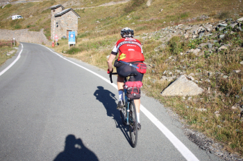
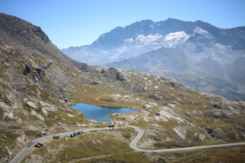
Stradista towards the Nivolet Pass.
Lake Rosset and Basei
Col Leynir
Descent, view of Gran Paradiso
Lake Losere
Descent, Lake Ceresole