Italiano
 Deutsch
Monte Pagano Wild

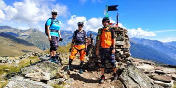
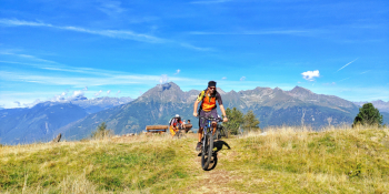
Mount Pagano represents one of the most spectacular spots to view the Camonica Valley and where you will find the remains of a beautiful dry-built military fort. But the descent? Wild and above all exciting.
We park in Monno (BS) in the middle of the village, with the advice not to arrive too late to the start because in summer places are limited. We go up the main road in the direction of the Mortirolo Pass to Mustù where one of the most beautiful roads in Valcamonica begins, namely the Dritta, which with gradients between 9% and 25% will take you up to Ponte Palò, above the Valle di Varadega streams. At this we are practically near the Belvedere where there are also the church of San Giacomo and the Mortirolo Barracks. I voluntarily continued with the trail to the Mortirolo Pass to admire this point as well. Now the direction will be the beautiful Grom Valley, an enchanted valley full of alpine pastures and lush greenery. Still on a secondary paved road we will arrive at the entrance of a gippabile and unpaved road: a few pedalings and we will arrive at the famous Pianaccio where the view will be stupendous. From the Pianaccio we will return toward the entrance of the trail on a slight descent that we will enjoy for good, before the last part of the ascent. It will be about 10 beautiful minutes where we let the bike flow and breathe deeply. When we reach the mouth of the military trail, we will turn left and have the last 300 meters of ascent to tackle. Tough but remarkably satisfying it will take you to the top of Mount Pagano at 2,346 meters. Deserved rest, photo of the day and it's off for the descent all to experience. I recommend underhand the trail because some sections are not on the Open Maps. The first part will be the most scenic: we start on the technical, then flow and finally light boulder without particular problems. We will arrive at the junction made on the way out and turn right. Quick gippabile and then watch out on your left for an indentation: quick rip and then right again the Wild section begins. Here there is for no one: we enter the undergrowth on a wonderful, almost movie-like trail under lush Camuna vegetation and perfect grip under the tires. We'll have everything: flow, technical, bumpy, vertical and a few switchbacks but also a couple of tough passages. In short, all the ingredients for a wonderful descent. At Valmaggiore at the junction we turn left and on fast cemented road we return to the cars.
RECOMMENDED ROUTE FOR MOUNTAIN BIKE and/or E-BIKE ALL MOUNTAIN.
NB: At the time of entry this ride is all doable without any particular problems. We disclaim any responsibility for any inconvenience due to lack of maintenance of the trails or deterioration of the same due to external and/or natural agents and a wrong assessment of the tour.