Italiano
 Deutsch
Piz Olda 2500, DH 114 + News Belotti's Trails
A hard, different and kinky Piz Olda with long, killer descent. First along the spectacular and at times steep ridge of trail 114 with variations that avoid non-bikeable or dirty and messy sections, then series of new trails with fixed boulders, roots and pine needles, recently cleaned.
Ascent
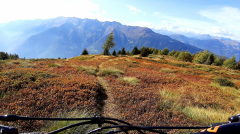
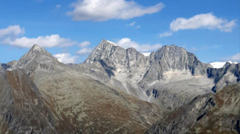
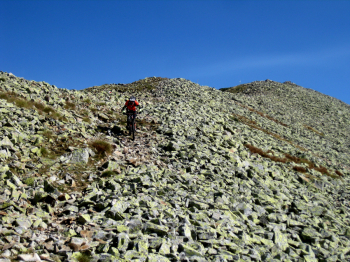
Start from Berzo (parking on the hairpin bend, by Oppol Bar), but you can also start from the valley floor with 300 meters more elevation gain. We go up the road in the direction of Cevo to the first houses of Monti where we turn left, over "muscle-warming" ramps, until we intersect the road to Loa. At the second hairpin bend we continue straight following in full the long, old military road from the Great War that leads below the summit of Piz. We continue, by the classic route to the summit, at an altitude of 2500. The view is grand, over the Adamello, which you seem to touch, over the Bernina, the Orobie, the Val Camonica...
Descent
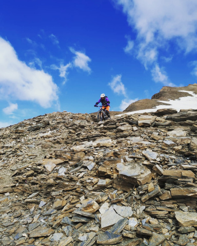
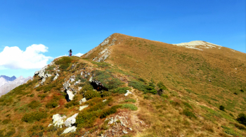
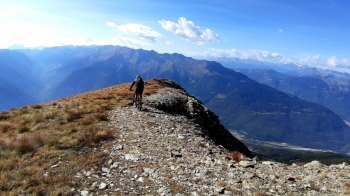
From the cross we first follow the rocky ridge, then keep left by track until we cross the ascent path. We soon abandon it to follow the ridge again to the military. We now have two options: continue on foot for a short distance along the very steep ridge or descend a few dozen meters along the military and then run a very free cut to rejoin the ridge and then 114 where it returns to bike. We now descend along the spectacular ridge for a stretch, then veer left along an imperceptible trail (watch your gps) returning to the military which we follow for a few meters to the hairpin bend. Down the ridge hard with a few sections of trail that would deserve a brush cutter pass but still spectacular.
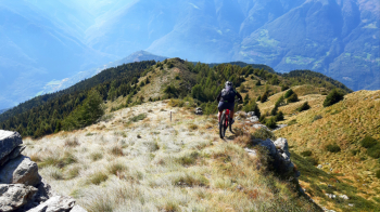
At an elevation of 1840 we leave 114 for good, turning left onto a truly libidinous trail (fixed boulders, roots and pine needles). At its end we will re-cross the military, which we immediately abandon for a short cut to the left that ends at Malga Aröt, meters 1740. From the malga straight down following the red-and-white markings. The trail ends again on the military, near a house, but we turn right going up a path for about seventy meters, then continuing along a spinning eat-and-drink trail to a fork. We turn sharply left and by another beautiful trail reach Malga Loa, meters 1197.
From the picnic area, with one last beautiful trail, crossing the Memorial Trail, we return ultra-satisfied to Berzo, ready for a cold beer at the Oppol Bar.