
 Italiano
 Deutsch
2023/08/29 16:20:23
Giro del Corno Nero e Pala Santa
Author

Place
Italy - Trentino-Alto Adige/Südtirol, TN
Km
47,89 km
Elapsed time
08:53:33
Vertical meters
+2 166 mt (1163 - 2034)
Route difficulty
Landscapes
Last update
2023/09/20 14:00:29
Comments
Hotels
Description
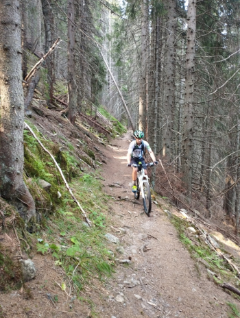
Itinerary around Corno Nero and Pala Santa, start from Ville di Fiemme (Daiano or Varena), go up to Passo Cugola, then Passo degli Oclini (with respect to the trail I recommend the forest road), Passo Lavazè and Passo Pampeago (first part of the trail is forbidden to bikes, the one under the chairlift, alternatively there is the cemented road) then on fun and flowing trail. Climb up steep forestry and after a small push section you rejoin the forestry trail that leads back to Lavazè Pass. Ascent to Sella dei pozzi and descent on trail (S2-S3).
Some pushing sections:
- Trail section from Cugola pass to Oclini pass (road recommended).
- From Lavazè pass the trail to Pampeago pass (post-vaia) (15 min).
- End of the forest trail that from Stava valley connects to the other forest trail to Lavazè pass (10 min push).
Local weather
Thu 00:00

17 °C
Thu 12:00

23 °C
Fri 00:00
20 °C
Fri 12:00

22 °C
Sat 00:00
19 °C
Sat 12:00
23 °C
Graph
Nearest Routes
21,25 km
Km
+1 150 mt
Vertical meters
Route difficulty
Landscapes
34,48 km
Km
+1 457 mt
Vertical meters
Route difficulty
Landscapes
35,36 km
Km
+1 065 mt
Vertical meters
Route difficulty
Landscapes
33,67 km
Km
+1 230 mt
Vertical meters
Route difficulty
Landscapes
27,60 km
Km
+1 400 mt
Vertical meters
Route difficulty
Landscapes
21,06 km
Km
+530 mt
Vertical meters
Route difficulty
Landscapes
38,74 km
Km
+1 130 mt
Vertical meters
Route difficulty
Landscapes
36,90 km
Km
+1 604 mt
Vertical meters
Route difficulty
Landscapes
60,06 km
Km
+3 200 mt
Vertical meters
Route difficulty
Landscapes
2023/07/31
- Italy - Trentino-Alto Adige/Südtirol, TN 30,70 km
Km
+1 450 mt
Vertical meters
Route difficulty
Landscapes