
 Italiano
 Deutsch
Passo 5 Croci - Rifugio Caldenave
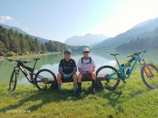
We set off uphill from Rifugio Carlettini in Val Campelle at 1360 meters in the direction of Passo 5 Croci (WP03), which we will reach after 7.8 km on comfortable forestry with steady gradients. We are just above an altitude of 2000 and from this position we can admire the valley to the south from where we started and the black walls of the Lagorai to the north.
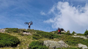
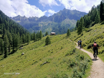
We now descend from the opposite side of the pass for 2 km until we reach Malga Val Cion (1975 meters, WP04). The easy and comfortable part of the trail ends here, from now on the wild ruggedness of the Lagorai will take their toll in order to enjoy their beauty. A little more than 1 km separates us from the Val Cion Pass (WP05), which we manage to do almost all in the saddle except for a few short pushing sections. Our next destination are the Laghi di Rocco (WP07) which are 1.5 km away; for a few hundred meters we will manage to descend while staying on the bike, then the "usual" Lagorai boulders ranging in size from large to very large will hinder our progress not a little; when even pushing the bike will be a problem we will necessarily have to continue with the bike on our shoulders.
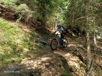
Once we reach the lakes at an altitude of 2135 meters the descent begins; unfortunately, before we can let go riding our bikes we will have to trudge among boulders and roots for another 2 km until we reach Malga Valsorda at 1909 meters (WP08). Finally, after 14.2 km from the start, we can enjoy almost 3 km of descent on a nice trail that will take us back to the forest road we rode on the way out.
We descend to the Conseria bridge (1470 meters, WP02) and take a left in the direction of Malga Nassere (1760 meters, WP09), which we will reach after 4 km on a slightly steeper forestry until the right-hand bend, then much softer. Another 2.5 km in the cool of the forest separates us from Rifugio Caldenave (1800 meters, WP10) positioned above the beautiful plain of the same name.
Despite the hours spent so far we will have covered just 24 km. Time for a refreshment and we set off again to return to the cars. We retrace our steps towards the Caldenave bridge and take the path to the left that leads to the forestry "Ex cava Maffei" that without difficulty descends to the valley. Reaching the asphalt still a few more pedal strokes uphill and we will be back at Rif. Carlettini from where this adventure had begun.
NB: When we rode this route we did not go down the forestry road "Ex Cava Maffei" as per the published trail but took the 2 trails that descend steeply towards Tedon (red trail on the photo).
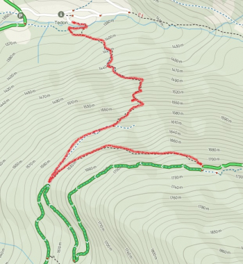
We tried but it was bad: we could not do them by bike as they were very narrow, rough and very steep. Personally, I'd rather do an easy forest trail downhill than walk on a goat path with the hindrance of a bike. Hence the reason for making public a different file than the one actually recorded. Then if someone wants to try their hand at the super technical they have seen where to get the trails.
Francis 31/07/2023


