HOME RANKINGS CHALLENGES ROUTES NEAR ME PLANNING SEARCH LOGIN
Italy - Piemonte, TO
2023/08/15 16:45:46

Colle Sommelier

42 Downloads
0
 
Share

Key Takeaways / Scheda Tecnica

Disciplina:
Mountain Bike (MTB)
Percorso:
Colle Sommelier
Località:
Italy - Piemonte, TO
Distanza:
53,81 km
Dislivello Positivo:
+2 000 mt (Quota Min: 1198m - Max: 3033m)
Difficoltà Tecnica:
2/5
Valutazione Panorami:
4/5
Formato Traccia:
GPX Download disponibile
Author
pozzoligio
(93)
Place
Italy - Piemonte, TO
Km
53,81 km
Elapsed time
07:22:21
Vertical meters
+2 000 mt (1198 - 3033)
Route difficulty
Landscapes
Last update
2023/08/16 07:50:30
Comments
0
Description

Classic tour to the Sommelier Pass starting in Bardonecchia, it is 26 km of almost continuous but never too steep climbing. It starts in Bardonecchia on asphalt with some somewhat steep sections until Rochemolles where it becomes a dirt road with a flat section next to the lake. Along the climb there are 4 signs indicating distance and gradient, the first at Rifugio Scarfiotti where you go right.

Foto itinerario MTB Colle Sommelier - Italy - Piemonte, TO

Ahead you see an endless series of switchbacks but the gradient is always steady around 8% to the top.

Foto itinerario MTB Colle Sommelier - Italy - Piemonte, TO

Foto itinerario MTB Colle Sommelier - Italy - Piemonte, TO

After a long straight valley you come to the last endless series of switchbacks leading to the pass, as you climb the road gets a little worse and worse.

Foto itinerario MTB Colle Sommelier - Italy - Piemonte, TO

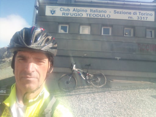
At the top there is an enclosed building and a pond, I recommend climbing up to the poles just above the hut.

Foto itinerario MTB Colle Sommelier - Italy - Piemonte, TO

Foto itinerario MTB Colle Sommelier - Italy - Piemonte, TO

The pond. You go back down the same road and get a better view of the waterfall above the hut.

Foto itinerario MTB Colle Sommelier - Italy - Piemonte, TO

Just below the lake you go left on the nice flat trail to Fregusia, then I followed a smooth descent with a very short section that was a bit steep, then left nice scenic trail with nice views of Bardonecchia.

Download our free mobile app to send this route to your Garmin device or to navigate it on OSM maps. Android - iOS
Local weather
Mar 00:00
9 °C
Mar 12:00
9 °C
Mer 00:00
8 °C
Mer 12:00
12 °C
Gio 00:00
3 °C
Gio 12:00
10 °C
Ven 00:00
6 °C
Ven 12:00
7 °C
Sab 00:00
3 °C
Sab 12:00
5 °C

Graph

Nearest Routes

38,64 km
Km
+1 850 mt
Vertical meters
Route difficulty
Landscapes
2026/06/28
- Italy - Piemonte, TO
gmzolenart
(137)
34,20 km
Km
+1 300 mt
Vertical meters
Route difficulty
Landscapes
2025/07/23
- Italy - Piemonte, TO
niciz
(2)
29,52 km
Km
+1 500 mt
Vertical meters
Route difficulty
Landscapes
50,21 km
Km
+3 250 mt
Vertical meters
Route difficulty
Landscapes
2025/12/05
- Italy - Piemonte, TO
ValeBG
(181)
57,35 km
Km
+3 600 mt
Vertical meters
Route difficulty
Landscapes
23,59 km
Km
+964 mt
Vertical meters
Route difficulty
Landscapes
2022/09/23
- France
43,32 km
Km
+2 700 mt
Vertical meters
Route difficulty
Landscapes
2023/06/01
- Italy - Piemonte, TO
Staff
(110)
26,86 km
Km
+1 560 mt
Vertical meters
Route difficulty
Landscapes
2024/08/24
- France
miciolo
(55)
43,94 km
Km
+1 783 mt
Vertical meters
Route difficulty
Landscapes
2024/08/22
- France
miciolo
(55)
35,69 km
Km
+1 428 mt
Vertical meters
Route difficulty
Landscapes

0 Comments