HOME RANKINGS CHALLENGES ROUTES POI PLANNING SEARCH LOGIN
Italy - Trentino-Alto Adige/Südtirol, TN
2023/07/06 18:05:02

Lagorai, forcelle Magna e Buse Tedesche

56 Downloads
0
 
Share
Author
miciolo
(40)
Place
Italy - Trentino-Alto Adige/Südtirol, TN
Km
25,18 km
Elapsed time
08:54:46
Vertical meters
+1 310 mt (1318 - 2343)
Route difficulty
Landscapes
Last update
2023/07/06 18:13:11
Comments
2
Description

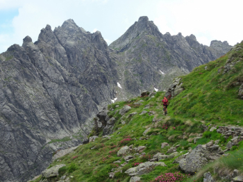
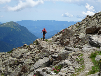
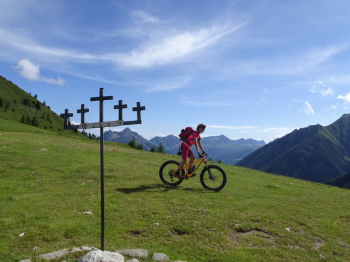
Departure from Cenon di Sotto in Val Campelle. Ascend first on asphalt then on a nice dirt road to Passo 5 Croci. Trail up to the Forcella Magna pedalable at times with beautiful views of the Cima d'Asta Group After the Forcella Magna we climb up to the homonymous Laghetto and begin a long stretch up to the Forcella delle Buse Todesche where there will be more pushing/shouldering than pedaling.

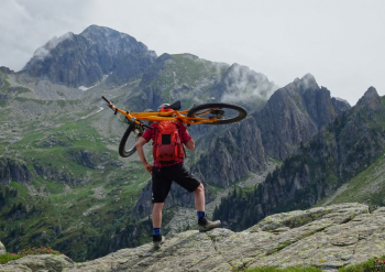
From the Forcella our descent starts in the direction of Baito Cengello where you will still find several "difficult" sections. From the Baito nice traverse until you reach Cocuzzolo dei Morti with its small War Cemetery. Now nosedive on Malga Conseria where a technical and fun trail starts and takes us back to the valley (be careful the entrance is not easy to find). This trail is a cyclo-mountaineering route. There are several push and shoulder-bike sections and it is a constant up and down from the bike due to rough terrain. It will be just you and your bike surrounded by wild and spectacular scenery.

Must like the genre though! Refrain if not motivated, the hike would become an ordeal. To get an idea, read the photoreport.
Download our free mobile app to send this route to your Garmin device or to navigate it on OSM maps. Android - iOS
Local weather
Oggi
0 °C
Stasera
-4 °C
Domani
5 °C
Domani sera
-1 °C
lunedì
6 °C
Lunedì notte
1 °C
martedì
6 °C
Martedì notte
3 °C
mercoledì
6 °C
Mercoledì notte
1 °C

Graph

Nearest Routes

2023/07/31
- Italy - Trentino-Alto Adige/Südtirol, TN
30,70 km
Km
+1 450 mt
Vertical meters
Route difficulty
Landscapes
2023/06/29
- Italy - Trentino-Alto Adige/Südtirol, TN
60,06 km
Km
+3 200 mt
Vertical meters
Route difficulty
Landscapes
2022/11/19
- Italy - Trentino-Alto Adige/Südtirol, TN
58,20 km
Km
+3 100 mt
Vertical meters
Route difficulty
Landscapes
2022/10/09
- Italy - Trentino-Alto Adige/Südtirol, TN
marco
(129)
34,48 km
Km
+1 457 mt
Vertical meters
Route difficulty
Landscapes
2023/07/11
- Italy - Trentino-Alto Adige/Südtirol, TN
27,71 km
Km
+1 560 mt
Vertical meters
Route difficulty
Landscapes
2023/08/29
- Italy - Trentino-Alto Adige/Südtirol, TN
Scc
(3)
47,89 km
Km
+2 166 mt
Vertical meters
Route difficulty
Landscapes
2022/08/16
- Italy - Trentino-Alto Adige/Südtirol, TN
gaspa91
(4)
17,79 km
Km
+929 mt
Vertical meters
Route difficulty
Landscapes
2023/02/26
- Italy - Trentino-Alto Adige/Südtirol, BZ
nonnocarb
(292)
38,74 km
Km
+1 130 mt
Vertical meters
Route difficulty
Landscapes
2024/02/15
- Italy - Trentino-Alto Adige/Südtirol, TN
21,53 km
Km
+1 150 mt
Vertical meters
Route difficulty
Landscapes
2024/10/01
- Italy - Veneto, VI
debonafr
(15)
30,08 km
Km
+1 400 mt
Vertical meters
Route difficulty
Landscapes

2 Comments