HOME RANKINGS CHALLENGES ROUTES NEAR ME PLANNING SEARCH LOGIN
Austria
2023/06/22 10:39:37

Bergkasteltrail e 3LanderTrail

1 Downloads
0
 
Share
Author
Place
Austria
Km
43,66 km
Elapsed time
00:00:00
Vertical meters
+500 mt (0 - 2487)
Route difficulty
Landscapes
Last update
2023/06/23 08:15:25
Comments
0
Description

Tour with lifts but with a beautiful pedaled part (it's about 2000m downhill and 500m uphill) that runs along the 3lander Trail straddling the borders of Italy, Austria and Switzerland.

We start in Nauders following the bike path to the first lift (BERGKASTEL) and then the Zirmbahn Chairlift that takes us to 2500m. We warm up on the Zirmtrail, then AlmTrail and arrived at the Stieralm hut we take on the Bergkastel Trail, for me one of the most beautiful in the trail area with just the right mix of natural and worked, never too rocky or full of roots (I have a full 120mm, not exactly ideal for riding at the 3Lander Enduro Trails without crumbling back and wrists). We take the bike path through the valley floor meadows and trespass into Italy, essaying the Belpiano lift at Lake Resia.

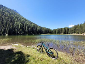
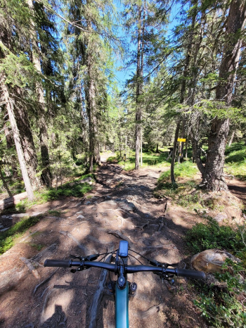
From the summit we can choose to follow either the Schöneben Trail or the Flowtrail (in the trail), which travels more or less parallel. The first more natural enduro, the other very ''combed'' with banks etc. the 2 trails come together at the beginning of the 3 Lander Trail. We first travel along a wide forest that goes resting and then when we reach the Swiss border it becomes a narrow path between 2 fences. we continue by reaching a small lake and then we descend among a thousand roots towards the valley taking the Gerry Trail to Nauders.
Download our free mobile app to send this route to your Garmin device or to navigate it on OSM maps. Android - iOS
Local weather
Tonight
-6 °C
Tomorrow
2 °C
Tomorrow night
-5 °C
Friday
-3 °C
Friday night
-13 °C
Saturday
-1 °C
Saturday night
-5 °C
Sunday
6 °C
Sunday night
2 °C
Monday
6 °C

Graph

Nearest Routes

52,93 km
Km
+350 mt
Vertical meters
Route difficulty
Landscapes
2024/02/02
- Italy - Trentino-Alto Adige/Südtirol, BZ
nonnocarb
(292)
26,70 km
Km
+600 mt
Vertical meters
Route difficulty
Landscapes
2023/07/03
- Italy - Trentino-Alto Adige/Südtirol, BZ
@ff.mtb
(9)
62,82 km
Km
+2 000 mt
Vertical meters
Route difficulty
Landscapes
2023/02/26
- Italy - Trentino-Alto Adige/Südtirol, BZ
nonnocarb
(292)
31,06 km
Km
+1 120 mt
Vertical meters
Route difficulty
Landscapes
2023/02/26
- Italy - Trentino-Alto Adige/Südtirol, BZ
nonnocarb
(292)
32,12 km
Km
+876 mt
Vertical meters
Route difficulty
Landscapes
2023/02/26
- Italy - Trentino-Alto Adige/Südtirol, BZ
nonnocarb
(292)
36,98 km
Km
+800 mt
Vertical meters
Route difficulty
Landscapes
2023/03/06
- Italy - Trentino-Alto Adige/Südtirol, BZ
nonnocarb
(292)
31,43 km
Km
+1 420 mt
Vertical meters
Route difficulty
Landscapes
2023/02/26
- Italy - Trentino-Alto Adige/Südtirol, BZ
nonnocarb
(292)
12,46 km
Km
+900 mt
Vertical meters
Route difficulty
Landscapes
2023/09/27
- Italy - Trentino-Alto Adige/Südtirol, BZ
77,02 km
Km
+3 100 mt
Vertical meters
Route difficulty
Landscapes
2023/03/06
- Italy - Trentino-Alto Adige/Südtirol, BZ
nonnocarb
(292)
47,44 km
Km
+1 800 mt
Vertical meters
Route difficulty
Landscapes

0 Comments