
 Italiano
 Deutsch
Alpe Prato del Conte

Route only partly advisable because of the non-bikeable path from Alpe Prato del Conte to Munt dei Taparei at an elevation of 900 meters. In practice the best thing to do is to go up to Uschione, continue to the road until it intersects the downhill trail, keeping in mind that this is also very technical and not for everyone.
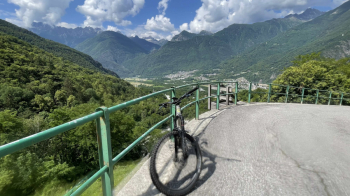
The climb is tough, quite steep and exposed to the sun. The fountain is at the top, at Alpe Prato del Conte, where you will arrive nicely brazed also because there is a push piece of about 300 meters of elevation gain to be done on trail. On the other hand, the paved road is traffic-free and offers some nice views of the Valchiavenna.
On the way up we will take another small asphalt road passing over (or under) a barrier. We descend for a few hairpin bends and then resume grinding meters of elevation gain, thus arriving at the push section.
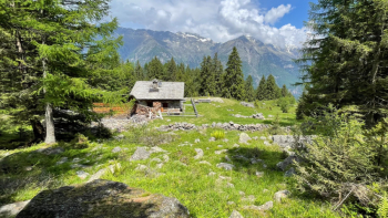
Alpe Prato del Conte has two nice things: the view toward the Bregaglia valley and a very cool fountain.
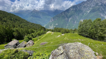
The trail looks inviting, as they have even cut the grass to highlight it, too bad that past the little wall (100 meters from the house) you have a hard time finding it in the woods and it turns out to be impassable except for short stretches: rocks of all sizes in the middle of the maroons, steps, big steps. In short, a downhill walk with bike in tow. The only resting places are the meadows at the alps below.
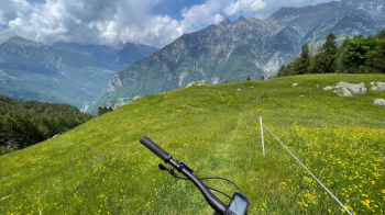
To give you a sense of where we are, look at the valley below us:
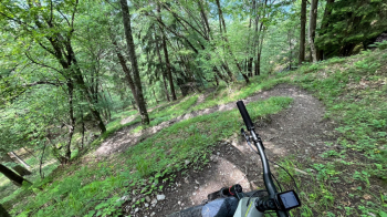
In short, up to elevation 900 you will regret coming up here. Then, at last, you catch a glimpse of bike tracks and the trail becomes doable, with a spectacular trail through the woods and a series of nice clean switchbacks.
Trail sections remain where 99 percent of the people will push, and there are many.
During the ride (June 8, 2023) I saw no less than 3 adders. I politely asked one to let me pass because it was on a small bridge I had to cross.
The original text was edited by Marco who acted as a guinea pig.