
 Italiano
 Deutsch
Forcella Medesc e Armentarola

A mountain biking tour between Val Badia and the Fanes Plateau, featuring a long and spectacular push section.
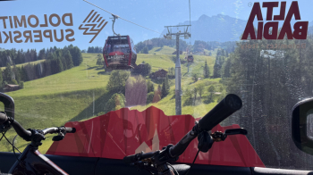
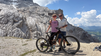
Start from the Bikehotel Tofana in San Cassiano. Follow the road/bike path downhill toward La Valle, then take the dirt road that runs along the left bank of the stream to reach Badia, where we take the La Crusc 1 and 2 cable cars all the way to the top. This cable car is part of the Dolomiti Supersummer ski area and transports bikes.
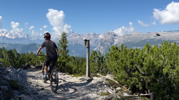
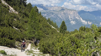
From the picturesque little church of Santa Croce, we take Trail No. 15 to the right, which, with several ups and downs, leads us to the junction for the trail that climbs toward the Medesc Pass.
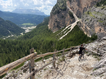
Here, you’ll initially push your bike along a trail full of roots, which after a while becomes more rideable, until you emerge from the woods and catch sight of the gully/scree slope where you’ll have to push your bike for a 500-meter climb to Forcella Medesc. Be sure to bring plenty of water, because there won’t be any until you reach the Lavarella refuge, and the entire climb is in direct sunlight. It’s a climb where you’ll mostly have to push your bike; on rare occasions, you’ll be able to ride it. I strongly recommend stopping to take a few photos along the way, as the scenery is fantastic and makes you forget the effort.
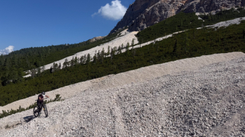
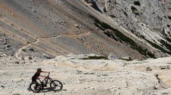
Always follow the switchbacks; it’s the best route to avoid ending up on the steep scree slope. The final traverse is narrow, and clearly to your right, the scree slope is steep and can be a bit daunting if you don’t have a steady footing or if you’re afraid of heights. In any case, if you slip, just stop—don’t worry. The sense of accomplishment upon making it is immense.
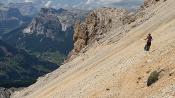
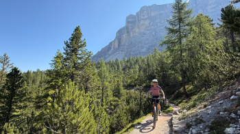
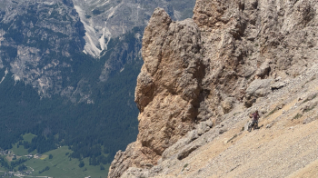
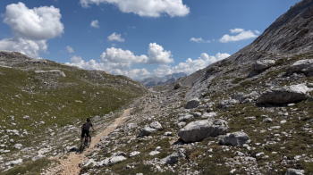
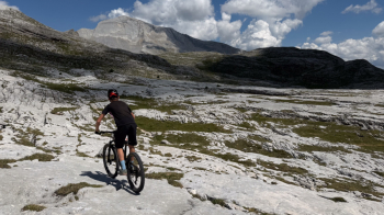
From here begins a series of ups and downs through a lunar landscape—the Fanes Plateau. At times, the trail will require you to get off your bike, but the only real thing to watch out for is to follow the trail marked “Fanes” to the LEFT! The path on the right is impossible to ride. This will take you to the Lavarella mountain hut, where you can eat and drink to your heart’s content. Be aware that from the Medesc Pass onward there’s no cell service, so it’s recommended to have a phone with satellite reception—like the new iPhones—in case of an emergency.
From Lavarella, follow the dirt road that leads first to the Fanes Mountain Hut, and then to Ju de Limo, a small pass that is quite steep. From here, enjoy the view of the surrounding mountains, then head right toward “Capanna Alpina.” At first, the valley is flat and gentle, with one or two short inclines where you’ll need to push your bike briefly; from Col de Locia, things change drastically: the trail becomes extremely rocky, with many steps and technical sections (S3) that aren’t always safe to ride. Not only that, but if you do this ride on the weekend, you’ll encounter quite a few hikers. We did it on Saturday, June 20, 2026, and every single one—and I mean every single one—of the hikers cheered us on and applauded us, both on the climb toward the Medesc Pass (6 people in all) and during the descent toward Armentarola.
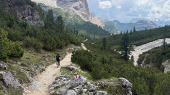
I really enjoyed the descent—it had just the right amount of technical challenge—but we came across people on e-bikes who had done the entire route on foot. Once you reach the bottom, follow the easy trail and then the dirt road to the Capanna Alpina, and then on the Falzarego Pass road, turn right to return to San Cassiano.
The elevation gain does not include the 700 meters covered by the cable car.


