
 Italiano
 Deutsch
2023/08/07 11:44:04
Col di Champillon
Author
Place
Italy - Valle d'Aosta, AO
Km
24,43 km
Elapsed time
00:00:00
Vertical meters
+1 450 mt (1248 - 2709)
Route difficulty
Landscapes
Last update
2023/08/07 16:48:57
Comments
Hotels
Description
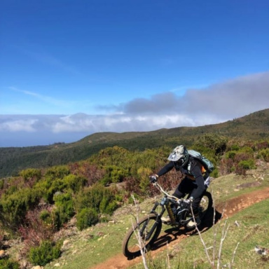
Revisiting the somme's ride, one could already find some descriptions about it but none complete with trail. Nice little ride with velvety descents, starting at Champillon col with a beautiful singletrcack interrupted only by stones to drain water of the "slicing wheels-I'm two and a half ounces what do I do? Do I leave?" Turn left and the traverse begins once you take trail 22 from the Crou de Bleintse pass, which for about 1 km turns out to be an up and down not-so-wide, with a few push points that ends in a few meters of downhill ravaging to then resume a nice, sexy, more beaten path, very flowy and very nice. Final stage on avoidable trail-muletrack starting at Laville. Found several water sources at 2 alpine pastures and at the hut.
Local weather
Wed 00:00

21 °C
Wed 12:00

25 °C
Thu 00:00

17 °C
Thu 12:00
25 °C
Fri 00:00

18 °C
Fri 12:00
21 °C

Graph
Nearest Routes
106,52 km
Km
+5 400 mt
Vertical meters
Route difficulty
Landscapes
37,82 km
Km
+2 300 mt
Vertical meters
Route difficulty
Landscapes
23,52 km
Km
+2 100 mt
Vertical meters
Route difficulty
Landscapes
2022/10/24
- Italy - Valle d'Aosta, AO 69,26 km
Km
+1 967 mt
Vertical meters
Route difficulty
Landscapes
30,80 km
Km
+1 141 mt
Vertical meters
Route difficulty
Landscapes
39,20 km
Km
+2 160 mt
Vertical meters
Route difficulty
Landscapes
37,94 km
Km
+2 399 mt
Vertical meters
Route difficulty
Landscapes
31,30 km
Km
+2 574 mt
Vertical meters
Route difficulty
Landscapes
29,77 km
Km
+1 356 mt
Vertical meters
Route difficulty
Landscapes
19,70 km
Km
+299 mt
Vertical meters
Route difficulty
Landscapes