HOME RANKINGS CHALLENGES ROUTES NEAR ME PLANNING SEARCH LOGIN
Italy - Trentino-Alto Adige/Südtirol, BZ
2023/03/06 09:10:28

Lenzeben alla rovescia da Merano

4 Downloads
0
 
Share
Author
nonnocarb
(292)
Place
Italy - Trentino-Alto Adige/Südtirol, BZ
Km
31,04 km
Elapsed time
00:00:00
Vertical meters
+1 800 mt (300 - 2035)
Route difficulty
Landscapes
Last update
2023/03/06 15:43:08
Comments
0
Description

Very challenging route, both for the very steep ascent and the very technical descent, but with beautiful views of Merano and its surroundings.
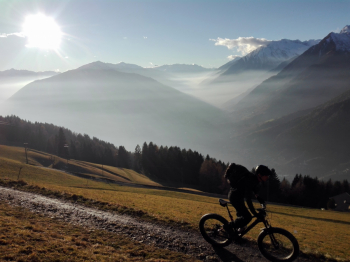
By e-bike it is fully pedaled, by regular bike some pushing depending on ability. From the center of Merano, go up immediately to St. Georgen and then to Taser, turn off onto the forest trail that climbs steeply until you reach the path down from Lanzeben.
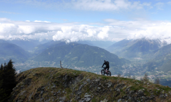
You ascend on the very steep trail, which is usually done backwards. With frequent breaks, given the maximum gradient at 26%, you manage to pedal to the top (having strength and technique). Then 20 minutes of shoulder biking to the Egger viewpoint. From here descend to Lenzeben, then to the Ivigna hut, very nice with refreshments. Now begins a very challenging but very fun technical trail, then more steep but faster trails almost to Merano.
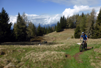
Download our free mobile app to send this route to your Garmin device or to navigate it on OSM maps. Android - iOS
Local weather
°C
°C
°C
°C
°C
°C
°C
°C
°C
°C

Graph

Nearest Routes

2023/03/04
- Italy - Trentino-Alto Adige/Südtirol, BZ
nonnocarb
(292)
86,35 km
Km
+1 800 mt
Vertical meters
Route difficulty
Landscapes
2023/03/04
- Italy - Trentino-Alto Adige/Südtirol, BZ
nonnocarb
(292)
49,70 km
Km
+1 600 mt
Vertical meters
Route difficulty
Landscapes
2023/03/04
- Italy - Trentino-Alto Adige/Südtirol, BZ
nonnocarb
(292)
52,00 km
Km
+1 080 mt
Vertical meters
Route difficulty
Landscapes
2023/03/01
- Italy - Trentino-Alto Adige/Südtirol, BZ
nonnocarb
(292)
40,77 km
Km
+1 500 mt
Vertical meters
Route difficulty
Landscapes
2024/07/25
- Italy - Trentino-Alto Adige/Südtirol, BZ
nonnocarb
(292)
81,06 km
Km
+2 150 mt
Vertical meters
Route difficulty
Landscapes
2023/03/04
- Italy - Trentino-Alto Adige/Südtirol, BZ
nonnocarb
(292)
96,84 km
Km
+2 220 mt
Vertical meters
Route difficulty
Landscapes
2023/03/01
- Italy - Trentino-Alto Adige/Südtirol, BZ
nonnocarb
(292)
69,97 km
Km
+1 740 mt
Vertical meters
Route difficulty
Landscapes
2024/09/18
- Italy - Trentino-Alto Adige/Südtirol, BZ
nonnocarb
(292)
56,20 km
Km
+2 300 mt
Vertical meters
Route difficulty
Landscapes
2023/02/26
- Italy - Trentino-Alto Adige/Südtirol, BZ
nonnocarb
(292)
48,20 km
Km
+1 800 mt
Vertical meters
Route difficulty
Landscapes
2024/09/04
- Italy - Trentino-Alto Adige/Südtirol, BZ
nonnocarb
(292)
64,42 km
Km
+1 900 mt
Vertical meters
Route difficulty
Landscapes

0 Comments