

 Italiano
 Deutsch
2024/09/04 21:29:49
Passo Castrin offroad dalla val d'Ultimo
Author

Place
Italy - Trentino-Alto Adige/Südtirol, BZ
Km
64,42 km
Elapsed time
05:47:53
Vertical meters
+1 900 mt (285 - 1949)
Route difficulty
Landscapes
Last update
2024/09/04 22:06:10
Comments
Description
Very long route starting from Merano, possibly you can start from San Pancrazio. Ideal for E-bike, but doable anyway.
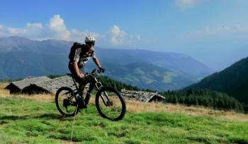
You go up the Val d'Ultimo as much as possible on trails, until you get to Lake Zoccolo. Then up again, Spitzner hut, Gampen hut and then again a nice trail leads to Castrin hut. From here a very long and fun trail leads back to San Pancrazio. In the center of the village a large stone reminds us that we are right on the Giudicare line, the tectonic line dividing the European and African plates.
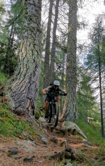
Very beautiful views and challenging uphill, flat and downhill trails. To get to the Spitzen alpine hut I made a cut going up on a very steep and bumpy trail, for e-bikes only, eventually just going up following the forest road signs.
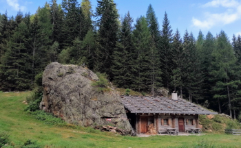
Local weather
Tue 00:00

15 °C
Tue 12:00

17 °C
Wed 00:00

15 °C
Wed 12:00
14 °C
Thu 00:00

13 °C
Thu 12:00

15 °C

Graph
Nearest Routes
64,38 km
Km
+2 300 mt
Vertical meters
Route difficulty
Landscapes
2023/02/26
- Italy - Trentino-Alto Adige/Südtirol, BZ 48,20 km
Km
+1 800 mt
Vertical meters
Route difficulty
Landscapes
2023/03/04
- Italy - Trentino-Alto Adige/Südtirol, BZ 47,13 km
Km
+1 100 mt
Vertical meters
Route difficulty
Landscapes
2024/09/18
- Italy - Trentino-Alto Adige/Südtirol, BZ 56,20 km
Km
+2 300 mt
Vertical meters
Route difficulty
Landscapes
44,14 km
Km
+2 100 mt
Vertical meters
Route difficulty
Landscapes
2023/03/01
- Italy - Trentino-Alto Adige/Südtirol, BZ 69,97 km
Km
+1 740 mt
Vertical meters
Route difficulty
Landscapes
2023/03/04
- Italy - Trentino-Alto Adige/Südtirol, BZ 96,84 km
Km
+2 220 mt
Vertical meters
Route difficulty
Landscapes
2024/07/25
- Italy - Trentino-Alto Adige/Südtirol, BZ 81,06 km
Km
+2 150 mt
Vertical meters
Route difficulty
Landscapes
36,69 km
Km
+1 310 mt
Vertical meters
Route difficulty
Landscapes
71,62 km
Km
+1 820 mt
Vertical meters
Route difficulty
Landscapes