2023/03/04 10:38:54
Malga di Caprile
Author
Place
Italy - Trentino-Alto Adige/Südtirol, BZ
Km
49,70 km
Elapsed time
05:05:12
Vertical meters
+1 600 mt (269 - 1836)
Route difficulty
Landscapes
Last update
2023/03/04 18:21:54
Comments
Description
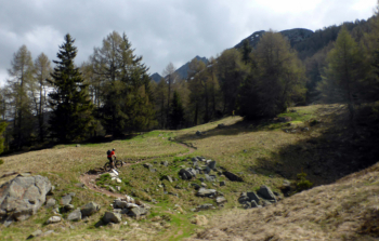
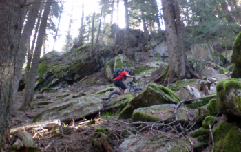
Very long itinerary, but also very satisfying because of the views and fun trails.

From Merano you reach Lana and then climb the via crucis (the name is a program). Before Tesimo you take the forest road to Plazzoles and then the new forest road to the Caprile hut (refreshment). From here descent on trail to the Plazzoles pass, all in beautiful woods, and then descent to San Pancrazio in Val d'Ultimo and back to Merano

Local weather

°C

°C

°C

°C

°C

°C
Graph
Nearest Routes
52,00 km
Km
+1 080 mt
Vertical meters
Route difficulty
Landscapes
40,77 km
Km
+1 500 mt
Vertical meters
Route difficulty
Landscapes
2024/07/25
- Italy - Trentino-Alto Adige/Südtirol, BZ 81,06 km
Km
+2 150 mt
Vertical meters
Route difficulty
Landscapes
2023/03/04
- Italy - Trentino-Alto Adige/Südtirol, BZ 96,84 km
Km
+2 220 mt
Vertical meters
Route difficulty
Landscapes
2023/03/01
- Italy - Trentino-Alto Adige/Südtirol, BZ 69,97 km
Km
+1 740 mt
Vertical meters
Route difficulty
Landscapes
2024/09/18
- Italy - Trentino-Alto Adige/Südtirol, BZ 56,20 km
Km
+2 300 mt
Vertical meters
Route difficulty
Landscapes
2023/02/26
- Italy - Trentino-Alto Adige/Südtirol, BZ 48,20 km
Km
+1 800 mt
Vertical meters
Route difficulty
Landscapes
2024/09/04
- Italy - Trentino-Alto Adige/Südtirol, BZ 64,42 km
Km
+1 900 mt
Vertical meters
Route difficulty
Landscapes
2023/03/04
- Italy - Trentino-Alto Adige/Südtirol, BZ 47,13 km
Km
+1 100 mt
Vertical meters
Route difficulty
Landscapes
44,14 km
Km
+2 100 mt
Vertical meters
Route difficulty
Landscapes


 Italiano
 Deutsch