HOME RANKINGS CHALLENGES ROUTES NEAR ME PLANNING SEARCH LOGIN
Italy - Trentino-Alto Adige/Südtirol, BZ
2023/03/04 08:28:35

Monte Penegal e monte Macaion da Merano

2 Downloads
0
 
Share
Author
nonnocarb
(292)
Place
Italy - Trentino-Alto Adige/Südtirol, BZ
Km
96,84 km
Elapsed time
09:40:44
Vertical meters
+2 220 mt (249 - 1860)
Route difficulty
Landscapes
Last update
2023/03/04 18:33:32
Comments
0
Description

Very hard and challenging route, only for very trained bikers. On the other hand, the views are fabulous and the trails very enjoyable.

From Merano you get to Eppan on bike path or secondary roads, then climb to the Mendel Pass and Mount Penegal. From here begins a very varied trail with challenging sections up to Mount Macaion, with fabulous views of the Dolomites and the Adige Valley.
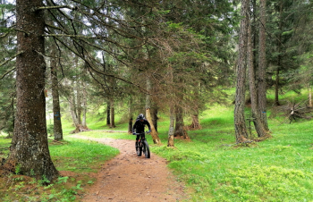
You now descend to the Fondo alpine hut and then, on a very steep and rocky road with many pushing sections, to Lake Tret. (You can also get there from trail 2 without losing elevation, with pushing sections).
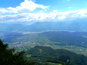
From here many more ups and downs, with final stretch on trail that forces you to get off your bike often, to Palade Pass. Descent on the sled track, then into the beautiful Mill Valley and on to Lana and back to Merano.

Download our free mobile app to send this route to your Garmin device or to navigate it on OSM maps. Android - iOS
Local weather
°C
°C
°C
°C
°C
°C
°C
°C
°C
°C

Graph

Nearest Routes

2023/03/01
- Italy - Trentino-Alto Adige/Südtirol, BZ
nonnocarb
(292)
69,97 km
Km
+1 740 mt
Vertical meters
Route difficulty
Landscapes
2024/07/25
- Italy - Trentino-Alto Adige/Südtirol, BZ
nonnocarb
(292)
81,06 km
Km
+2 150 mt
Vertical meters
Route difficulty
Landscapes
2023/02/26
- Italy - Trentino-Alto Adige/Südtirol, BZ
nonnocarb
(292)
48,20 km
Km
+1 800 mt
Vertical meters
Route difficulty
Landscapes
2024/09/18
- Italy - Trentino-Alto Adige/Südtirol, BZ
nonnocarb
(292)
56,20 km
Km
+2 300 mt
Vertical meters
Route difficulty
Landscapes
2024/09/04
- Italy - Trentino-Alto Adige/Südtirol, BZ
nonnocarb
(292)
64,42 km
Km
+1 900 mt
Vertical meters
Route difficulty
Landscapes
2023/03/01
- Italy - Trentino-Alto Adige/Südtirol, BZ
nonnocarb
(292)
40,77 km
Km
+1 500 mt
Vertical meters
Route difficulty
Landscapes
2023/03/04
- Italy - Trentino-Alto Adige/Südtirol, BZ
nonnocarb
(292)
52,00 km
Km
+1 080 mt
Vertical meters
Route difficulty
Landscapes
2023/03/04
- Italy - Trentino-Alto Adige/Südtirol, BZ
nonnocarb
(292)
47,13 km
Km
+1 100 mt
Vertical meters
Route difficulty
Landscapes
2024/11/18
- Italy - Trentino-Alto Adige/Südtirol, BZ
nonnocarb
(292)
44,14 km
Km
+2 100 mt
Vertical meters
Route difficulty
Landscapes
2023/03/05
- Italy - Trentino-Alto Adige/Südtirol, BZ
nonnocarb
(292)
36,69 km
Km
+1 310 mt
Vertical meters
Route difficulty
Landscapes

0 Comments