HOME RANKINGS CHALLENGES ROUTES NEAR ME PLANNING SEARCH LOGIN
Italy - Lombardia, BS
2026/10/22 09:31:00

Dorena e monte Pagano

1 Downloads
0
 
Share

Key Takeaways / Scheda Tecnica

Disciplina:
Mountain Bike (MTB)
Percorso:
Dorena e monte Pagano
Place:
Italy - Lombardia, BS
Km:
35,66 km
Vertical meters:
+2 200 mt (Quota Min: 901m - Max: 2349m)
Route difficulty:
4/5
Landscapes:
5/5
Formato Traccia:
GPX Download disponibile
Author
giannig
(38)
Place
Italy - Lombardia, BS
Km
35,66 km
Elapsed time
09:35:32
Vertical meters
+2 200 mt (901 - 2349)
Route difficulty
Landscapes
Last update
2026/10/22 14:01:21
Comments
0
Description

A Different Side of Pagano. This route takes you along the beautiful Dorena Trail, a long traverse at an elevation of about 2,000 meters, running along the eastern flank of Cima Cadì and Cima Verda, ending as it descends gently to Lake Mortirolo and the refuge of the same name.
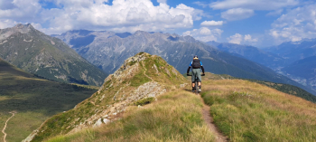
Foto itinerario MTB Dorena e monte Pagano - Italy - Lombardia, BS

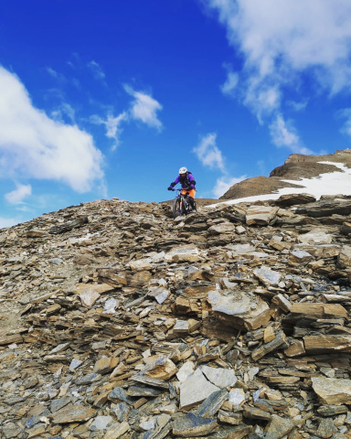
The route starts from the village of Incudine, at 910 meters (parking on the left after the bridge over the Oglio River). We head south along a very short stretch of the state highway, then turn right onto the road toward Monno. We soon leave the main road at an elevation of 950 meters for a small road that leads below the village, down to the Ogliolo di Monno stream. After climbing back up to the village, we return to the Mortirolo state highway, which we follow for a few hundred meters until the left fork for Rasega. In the village of Fracai, we keep to the right and, at an elevation of 1,510, take a right onto the Sentiero dei Boschi (some sections require pushing the bike). After a short stretch carrying the bike on our shoulders, we reach, at an elevation of 2,010, the beautiful trail coming from Malga Dorena.
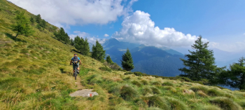
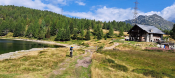
Foto itinerario MTB Dorena e monte Pagano - Italy - Lombardia, BS

Foto itinerario MTB Dorena e monte Pagano - Italy - Lombardia, BS

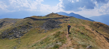
Turning right, we follow it to Lake Mortirolo and its mountain hut at 1,780 meters. From here, we descend along the Sentiero del Lac to an elevation of 1,700 meters; keeping to the left, we reach the Mortirolo road near the War Memorial (it is also possible to continue descending along the trail to its end at an elevation of 1,510 meters and climb back up via La Dritta to the bridge, adding 130 meters of elevation gain). We descend briefly to the Palö Bridge, at 1,640 meters, where we turn left onto the steep forest road that passes through the village of Plazza and leads up the old military trail to the summit of Mount Pagano, at 2,346 meters, surrounded by a distinctive dry-stone wall.
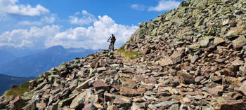
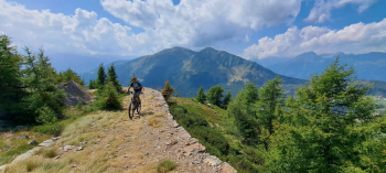
Foto itinerario MTB Dorena e monte Pagano - Italy - Lombardia, BS

Foto itinerario MTB Dorena e monte Pagano - Italy - Lombardia, BS

Foto itinerario MTB Dorena e monte Pagano - Italy - Lombardia, BS

After enjoying the magnificent view, the descent begins along the entire beautiful northeast ridge, with technical and tricky sections down to Pianaccio, 2,150 meters (caution).
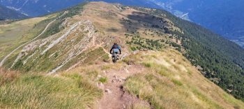
Foto itinerario MTB Dorena e monte Pagano - Italy - Lombardia, BS

Turning right, we follow a beautiful traverse along a smooth trail that brings us back to the military road we took on the ascent at an elevation of 2,020 meters.
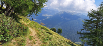
Foto itinerario MTB Dorena e monte Pagano - Italy - Lombardia, BS

We descend briefly along it to an elevation of 1,950 meters, where we turn left onto a trail and begin the fun descent. From here on, be careful to follow the trail closely to avoid descending along the forest road (for a stretch, the trail runs parallel above the road). After a final section that’s a bit tricky to follow, we return to Incudine and the car.
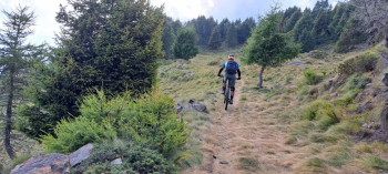
Foto itinerario MTB Dorena e monte Pagano - Italy - Lombardia, BS

Download our free mobile app to send this route to your Garmin device or to navigate it on OSM maps. Android - iOS
Local weather
Mon 00:00
1 °C
Mon 12:00
8 °C
Tue 00:00
3 °C
Tue 12:00
9 °C
Wed 00:00
8 °C
Wed 12:00
10 °C
Thu 00:00
9 °C
Thu 12:00
10 °C
Fri 00:00
9 °C
Fri 12:00
12 °C

Graph

Nearest Routes

2025/02/15
- Italy - Lombardia, BS
22,71 km
Km
+1 320 mt
Vertical meters
Route difficulty
Landscapes
2023/09/04
- Italy - Lombardia, BS
Giulien
(110)
30,12 km
Km
+1 531 mt
Vertical meters
Route difficulty
Landscapes
2022/09/22
- Italy - Lombardia, BS
35,87 km
Km
+1 835 mt
Vertical meters
Route difficulty
Landscapes
2022/09/07
- Italy - Lombardia, BS
giannig
(38)
16,40 km
Km
+1 300 mt
Vertical meters
Route difficulty
Landscapes
2024/05/19
- Italy - Lombardia, BS
Staff
(110)
19,17 km
Km
+1 250 mt
Vertical meters
Route difficulty
Landscapes
2026/10/21
- Italy - Lombardia, BS
giannig
(38)
35,88 km
Km
+2 180 mt
Vertical meters
Route difficulty
Landscapes
36,62 km
Km
+2 010 mt
Vertical meters
Route difficulty
Landscapes
2023/09/04
- Italy - Lombardia, BS
Giulien
(110)
27,19 km
Km
+1 698 mt
Vertical meters
Route difficulty
Landscapes
2023/12/25
- Italy - Lombardia, BS
Padagiant
(9)
20,55 km
Km
+1 300 mt
Vertical meters
Route difficulty
Landscapes
2024/06/25
- Italy - Lombardia, BS
giannig
(38)
31,58 km
Km
+1 800 mt
Vertical meters
Route difficulty
Landscapes

0 Comments