Italiano
 Deutsch
Monte delle Canelle, val d'Arano e Via delle Pere

One of the most beautiful enduro rides you can take in the area—especially on an e-bike! The route starts in Rovere and follows a secondary road (closed to traffic) to easily reach the Rifugio del Lupo (4 km); from there, the climb gets steeper, and another 2 km with a 220-meter elevation gain will take you to the Monte delle Canelle crossroads.
It starts at 10%, but the gradient gradually increases, reaching peaks of 30% in the final stretch; the underbrush is fantastic and offers incredible traction. Pay close attention: the trail you need to take is a variant of the 10F (Monte delle Canelle ridge). It’s located 30 meters before the four-way junction on the right, heading straight into the underbrush. It doesn’t have CAI markers but is clearly visible on the ground; if you follow the trail, you can’t go wrong. This variant is beautiful, and unlike the ridge, it’s entirely rideable!
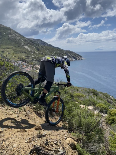
Continue along the variation; after a short climb, you’ll reach the first descent—fun and challenging. Watch out for the trail surface, which is very slippery in some sections. Once you exit the woods, a spectacular view toward Ovindoli opens up—you’ll definitely want to snap a photo. Ride through the village and continue toward Val D’Arano; settle in and enjoy the climb. Have a snack at the foot of Monte Savina and continue to the left. After a short descent, a steep, rocky stretch awaits you that will test both your stamina and your technique.
This is where the descent begins that will take you to Rovere—technical sections, hairpin turns, rocks, underbrush, and more—simply spectacular! (Always watch out for pedestrians.) At this point, you’ll have covered 27 km and 980 meters of elevation gain. If you’re satisfied, you can end the ride here, but my advice is to start over. Retrace the first 6 km and 350 meters of elevation gain to return to the Monte delle Canelle crossroads, then continue straight on the Via delle Pere—trail 10G. A spectacular descent through the woods, with a moderate slope and a soft, leaf-strewn surface that’s hard to see but offers little grip—though it’s almost rock-free. In some sections, it’s like a natural toboggan run with giant banks—an absolute blast!
Note: On an e-bike, the entire route is rideable, although there are sections that will test your technique and stamina.
If you’re biking, adjust your route based on your stamina; you can save about 450 meters of elevation gain by skipping Monte delle Canelle and heading straight toward Ovindoli (bike path) or by avoiding Via delle Pere at the end of the loop.