HOME RANKINGS CHALLENGES ROUTES NEAR ME PLANNING SEARCH LOGIN
Italy - Liguria, GE
2026/08/08 16:55:18

Monte Fasce e discesa su Sori

1 Downloads
0
 
Share

Key Takeaways / Scheda Tecnica

Disciplina:
Mountain Bike (MTB)
Percorso:
Monte Fasce e discesa su Sori
Località:
Italy - Liguria, GE
Distanza:
47,29 km
Dislivello Positivo:
+1 223 mt (Quota Min: 8m - Max: 822m)
Difficoltà Tecnica:
4/5
Valutazione Panorami:
4/5
Formato Traccia:
GPX Download disponibile
Author
Antosangui
(121)
Place
Italy - Liguria, GE
Km
47,29 km
Elapsed time
03:51:50
Vertical meters
+1 223 mt (8 - 822)
Route difficulty
Landscapes
Last update
2026/08/08 16:57:44
Comments
1
Description

A route that combines two trails in the Fasce area—the first more classic and well-known, the second more secluded. The route starts in downtown Genoa and follows a paved road uphill toward Fasce, ascending from the Borgoratti neighborhood. The climb is steady and doesn’t feature any particularly steep sections; even better, during these days of summer heat, it faces west, so many sections are in the shade in the morning.

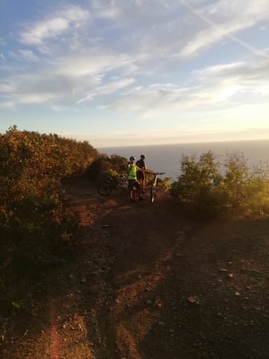
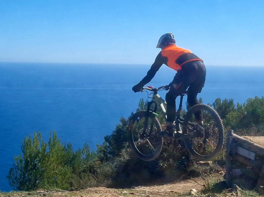
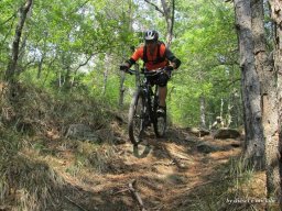
Once you reach the Fasce plaza, turn right and take the road leading to the summit where the antennas are located; here, the gradient increases. At the summit, take the Geometra trail—a well-maintained, grooved trail with great flow—which brings you back to the paved road you climbed earlier. Once back on the road, turn right and head back to the Fasce square. From there, continue along the provincial road for a few kilometers until you reach a trail on the right that isn’t very visible from the road—there’s a lot of vegetation. After just a few meters, the view opens up onto the Golfo Paradiso.
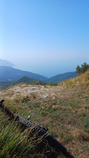
Foto itinerario MTB Monte Fasce e discesa su Sori - Italy - Liguria, GE

Here, take the trail on the right that leads all the way to Sori—a real treat. As of today, August 8, 2026, the trail has just been mowed and is perfectly passable. The trail alternates between sections of solid rock and loose rock, with a very beautiful stretch through the undergrowth. The view remains unparalleled throughout.
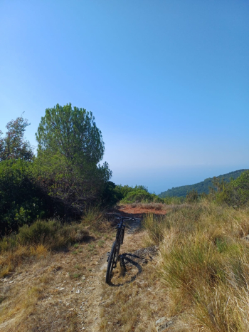
Foto itinerario MTB Monte Fasce e discesa su Sori - Italy - Liguria, GE

You’ll arrive in the old part of Sori, then return to Genoa via the Aurelia.

There are no drinking fountains along the way, except on the Aurelia Highway near Bogliasco.

Download our free mobile app to send this route to your Garmin device or to navigate it on OSM maps. Android - iOS
Local weather
Tue 00:00
19 °C
Tue 12:00
21 °C
Wed 00:00
18 °C
Wed 12:00
19 °C
Thu 00:00
17 °C
Thu 12:00
19 °C
Fri 00:00
15 °C
Fri 12:00
18 °C
Sat 00:00
14 °C
Sat 12:00
17 °C

Graph

Nearest Routes

2026/08/08
- Italy - Liguria, GE
Antosangui
(121)
42,36 km
Km
+1 564 mt
Vertical meters
Route difficulty
Landscapes
2026/03/29
- Italy - Liguria, GE
Antosangui
(121)
66,85 km
Km
+1 223 mt
Vertical meters
Route difficulty
Landscapes
2026/03/29
- Italy - Liguria, GE
Antosangui
(121)
27,08 km
Km
+1 003 mt
Vertical meters
Route difficulty
Landscapes
2022/08/25
- Italy - Liguria, GE
40,77 km
Km
+905 mt
Vertical meters
Route difficulty
Landscapes
2026/02/02
- Italy - Liguria, GE
tado79
(16)
45,44 km
Km
+1 800 mt
Vertical meters
Route difficulty
Landscapes
2023/04/06
- Italy - Liguria, GE
50,83 km
Km
+1 353 mt
Vertical meters
Route difficulty
Landscapes
2022/12/11
- Italy - Liguria, GE
BAROLO71
(35)
25,81 km
Km
+982 mt
Vertical meters
Route difficulty
Landscapes
2024/10/21
- Italy - Liguria, GE
Antosangui
(121)
26,26 km
Km
+1 264 mt
Vertical meters
Route difficulty
Landscapes
2023/03/23
- Italy - Liguria, GE
BAROLO71
(35)
23,29 km
Km
+1 011 mt
Vertical meters
Route difficulty
Landscapes
2023/03/26
- Italy - Liguria, GE
BAROLO71
(35)
27,63 km
Km
+1 300 mt
Vertical meters
Route difficulty
Landscapes

1 Comments