Italiano
 Deutsch
Monte Generoso - Orimento - Erbonne - Roncapiano

A classic route on Mount Generoso, straddling the border between Switzerland and Italy, featuring fun but not difficult descents, suitable even for XC bikes. The route starts in the Muggio Valley: there is plenty of free parking available in both Cabbio and Muggio. Ride downhill on the paved Cabbio Wall: a famous climb that road bike enthusiasts love to tackle. Shortly after crossing the bridge over the Breggia stream, the route climbs slightly and takes the Piantagioni trail: a pleasant, shaded climb that isn’t particularly steep, though it is somewhat exposed. The ride is smooth except for the last three tight hairpin turns, which require excellent technique.
You’ll then reach La Grassa, where it’s advisable to refill your water at the fountain with the wooden sculpture (a snail); a little further along the undulating path, you’ll come across a second fountain with a sculpture (an owl), though only a trickle of water comes out of it. After that, there will be no more fountains along the route until Erbonne (though you can refill your water at the restaurant near the railway’s summit station and later at the Orimento mountain hut).
You’ll cross the hilly area along a paved road, then take a trail that leads first through pastures and then through woods; after a few sections where you’ll have to push your bike, it joins the long traverse (elevation 1,300 meters) that leads to the summit station of the rack-and-pinion railway (elevation 1,600 meters). This section offers stunning views; it is initially easy to ride and partly shaded. Then, starting at 1,450 meters, the trail becomes very steep (gradients close to 20%), and the presence of retaining walls makes it very difficult to ride the entire section. WARNING: The traverse is designated as a pedestrian trail (sign posted at the start of the climb); however, cyclists are tolerated when riding uphill. In any case, always yield to pedestrians and absolutely avoid riding downhill on this section!
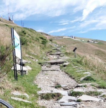
Final stretch of the climb to the summit station of Monte Generoso
Once you reach the summit station, if the weather is nice, I recommend leaving your bike and walking another 100 m of elevation gain to reach the actual summit of Monte Generoso (1701 m): from here, you can enjoy a magnificent 360° panoramic view of the surrounding mountains and lakes. This detour is not marked on the route.
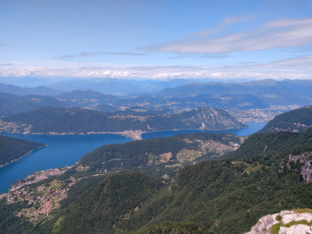
Lake Lugano as seen from the summit of Monte Generoso
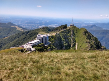
Fiore di Pietra and the summit station
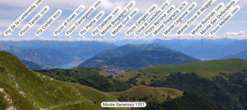
Panorama toward the northeast: Lake Lugano, Lake Como, and the Central Alps
You cross the border (you are now in Italy) and begin the descent: you follow the so-called “lower trail,” which is very scenic, initially somewhat exposed on steep meadows with some rocky sections (difficulty S1); then, shortly after Alpe Pesciò di Mezzo, an easy double track on gravel (S0) leads to the village of Orimento (1,275 m, refreshments available). From here, continue downhill to the picturesque village of Erbonne along a beautiful trail through the woods, at first not very steep but somewhat uneven, then with a few steeper sections on dirt and rock slabs (a few S2 passages). In Erbonne (950 m), there is a fountain and a tavern; be sure to check out the beautiful washhouse and the little church.
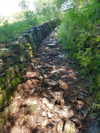
Trail from Orimento to Erbonne
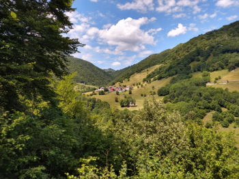
Erbonne (950 m)
Crossing the wooden bridge, you cross the Breggia River again and return to Switzerland, where a trail with ups and downs through the woods awaits (a couple of steep uphill sections on rock and steps that are difficult to ride), until you reach the village of Scudellate: you’re back in the Muggio Valley. From here, if you wish, you could head straight back to the car by taking the paved road downhill, but, since I still have some energy left, I pedal uphill along the final stretch of paved road to Roncapiano (fountain). From the small chapel at the end of the road, the most beautiful descent of the ride begins: the Runca trail, a fast and fun S1 trail with lots of tight turns—all perfect for carving through—until I reach yet another bridge over the Breggia. Here, a beautiful natural pool tempts me to take a dip, but unfortunately I only have time to ride the final uphill stretch of dirt road until I reach Muggio again and finish the ride!
Route completed on June 27, 2026, by mountain bike.