HOME RANKINGS CHALLENGES ROUTES NEAR ME PLANNING SEARCH LOGIN
Italy - Trentino-Alto Adige/Südtirol, BZ
2025/09/30 22:18:04

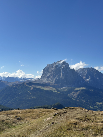
Seceda, Odle e Vallunga

4 Downloads
0
 
Share
Author
adibiase
(1)
Place
Italy - Trentino-Alto Adige/Südtirol, BZ
Km
33,18 km
Elapsed time
07:47:50
Vertical meters
+1 910 mt (1217 - 2594)
Route difficulty
Landscapes
Last update
2025/10/01 20:00:49
Comments
0
Description

Super scenic tour crossing the Seceda, the Odle group and then facing a fantastic technical descent to Vallunga.


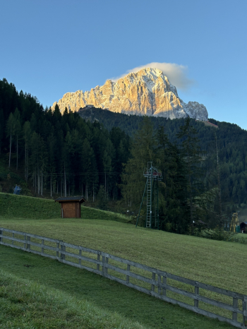
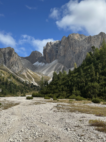
Starting in Selva di Val Gardena, after overnighting in my car in the parking lot of the Dantercepies ski lifts I will ride the bike path towards Ortisei where I will take the gondola and then the cable car to the Seceda peak.


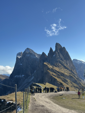
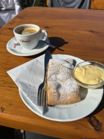
From there I will go to stop at Rifugio Firenze moving on singletrack. The lifts open at 8:30 a.m.: I strongly recommend to be very ready for the first gondolas of the day so as to be able to dodge the rivers of merenderos that will soon invade Seceda and its trails. Once we reach Rifugio Firenze, the most strenuous part begins: a tough climb (80 percent by pushing and/or with a backpacking bike) on trail No. 2 to Forcella de Sieles, but not before shooting myself a "bracing strudel" in anticipation of the fatigue.


The last part of the climb requires attention for non-trivial passages on an equipped trail.


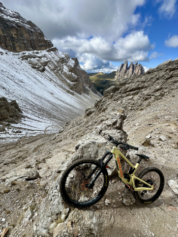
I continue on briefly to the junction leading toward Forcella Nives and the summit of Duledda, from here the descent to Vallunga begins.


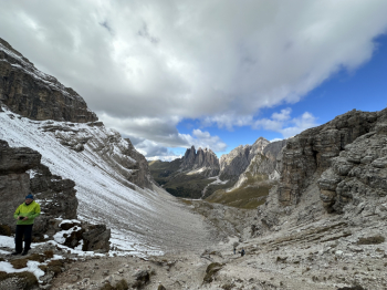
It is a technical descent that I identify between S2/S3 with some passages that require a lot of attention and/or to be done on foot, it will also cross the "wooden steps path" in which there are many switchbacks to close in nose press.


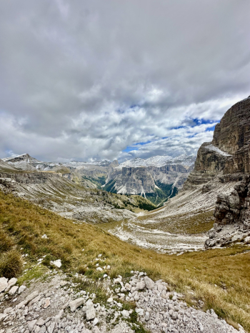
The descent will end in Vallunga on a dirt road that will take us back to our starting point.

Download our free mobile app to send this route to your Garmin device or to navigate it on OSM maps. Android - iOS
Local weather
Fri 00:00
10 °C
Fri 12:00
11 °C
Sat 00:00
9 °C
Sat 12:00
12 °C
Sun 00:00
9 °C
Sun 12:00
15 °C
Mon 00:00
9 °C
Mon 12:00
15 °C
Tue 00:00
12 °C
Tue 12:00
17 °C

Graph

Nearest Routes

2024/07/07
- Italy - Trentino-Alto Adige/Südtirol, BZ
Staff
(108)
64,78 km
Km
+370 mt
Vertical meters
Route difficulty
Landscapes
2024/07/07
- Italy - Veneto, BL
Staff
(108)
59,44 km
Km
+1 020 mt
Vertical meters
Route difficulty
Landscapes
2024/06/01
- Italy - Trentino-Alto Adige/Südtirol, BZ
Staff
(108)
51,53 km
Km
+2 800 mt
Vertical meters
Route difficulty
Landscapes
2022/11/01
- Italy - Trentino-Alto Adige/Südtirol, BZ
nonnocarb
(319)
51,53 km
Km
+2 551 mt
Vertical meters
Route difficulty
Landscapes
2023/09/14
- Italy - Trentino-Alto Adige/Südtirol, BZ
58,55 km
Km
0 mt
Vertical meters
Route difficulty
Landscapes
2024/05/08
- Italy - Trentino-Alto Adige/Südtirol, BZ
nonnocarb
(319)
43,35 km
Km
+2 300 mt
Vertical meters
Route difficulty
Landscapes
2023/01/31
- Italy - Trentino-Alto Adige/Südtirol, BZ
nonnocarb
(319)
28,18 km
Km
+1 467 mt
Vertical meters
Route difficulty
Landscapes
2023/02/26
- Italy - Trentino-Alto Adige/Südtirol, BZ
nonnocarb
(319)
44,97 km
Km
+1 590 mt
Vertical meters
Route difficulty
Landscapes
2023/03/04
- Italy - Trentino-Alto Adige/Südtirol, BZ
nonnocarb
(319)
35,57 km
Km
+2 000 mt
Vertical meters
Route difficulty
Landscapes
2024/09/18
- Italy - Trentino-Alto Adige/Südtirol, BZ
nonnocarb
(319)
44,65 km
Km
+2 000 mt
Vertical meters
Route difficulty
Landscapes

0 Comments