HOME RANKINGS CHALLENGES ROUTES POI PLANNING SEARCH LOGIN
Italy - Trentino-Alto Adige/Südtirol, BZ
2023/02/26 11:34:33

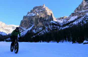
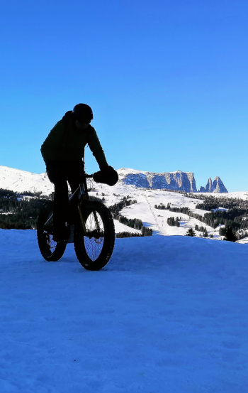
Vallunga e monte Pana sulla neve

4 Downloads
0
 
Share
Author
nonnocarb
(287)
Place
Italy - Trentino-Alto Adige/Südtirol, BZ
Km
44,97 km
Elapsed time
-456417:-18:-31
Vertical meters
+1 590 mt (1367 - 2067)
Route difficulty
Landscapes
Last update
2023/12/04 13:53:54
Comments
0
Description

Spectacular route on #snow in the heart of the beautiful Dolomites.

To be done by fat bike or even ebike with plus tires if the snow is now old and well groomed.

From Selva you descend to Santa Cristina on a bike path and climb to Mount Pana. From here begins a beautiful snowy road up to Mount Seura just below the Sassolungo. You descend on the same road and then climb to the Zallinger hut on a beautiful snowy trail at the foot of Sasso Piatto. From here a beautiful snowy descent to Saltria, then back to Mt. Pana, down on the trail to Santa Cristina and back to Selva on the bike path.

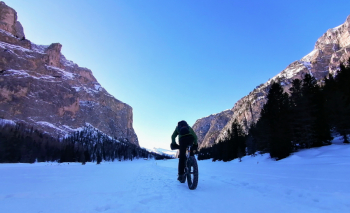
Now take the beautiful white Vallunga between imposing peaks, then back on snowy trail almost to the parking lot.

Snowy route usually doable from December to March, but completely doable even without snow.

Download our free mobile app to send this route to your Garmin device or to navigate it on OSM maps. Android - iOS
Local weather
Today
8 °C
Tonight
5 °C
Tomorrow
8 °C
Tomorrow night
3 °C
Friday
9 °C
Friday night
4 °C
Saturday
8 °C
Saturday night
5 °C
Sunday
10 °C
Sunday night
4 °C

Graph

Nearest Routes

2023/03/04
- Italy - Trentino-Alto Adige/Südtirol, BZ
nonnocarb
(287)
35,57 km
Km
+2 000 mt
Vertical meters
Route difficulty
Landscapes
2024/09/18
- Italy - Trentino-Alto Adige/Südtirol, BZ
nonnocarb
(287)
44,65 km
Km
+2 000 mt
Vertical meters
Route difficulty
Landscapes
2023/09/14
- Italy - Trentino-Alto Adige/Südtirol, BZ
58,55 km
Km
0 mt
Vertical meters
Route difficulty
Landscapes
2024/07/07
- Italy - Veneto, BL
Staff
(75)
59,44 km
Km
+1 020 mt
Vertical meters
Route difficulty
Landscapes
2024/07/07
- Italy - Trentino-Alto Adige/Südtirol, BZ
Staff
(75)
64,78 km
Km
+370 mt
Vertical meters
Route difficulty
Landscapes
2023/02/26
- Italy - Trentino-Alto Adige/Südtirol, BZ
nonnocarb
(287)
37,25 km
Km
+1 350 mt
Vertical meters
Route difficulty
Landscapes
2023/01/31
- Italy - Trentino-Alto Adige/Südtirol, BZ
nonnocarb
(287)
28,18 km
Km
+1 467 mt
Vertical meters
Route difficulty
Landscapes
2024/06/01
- Italy - Trentino-Alto Adige/Südtirol, BZ
Staff
(75)
51,53 km
Km
+2 800 mt
Vertical meters
Route difficulty
Landscapes
2022/11/01
- Italy - Trentino-Alto Adige/Südtirol, BZ
nonnocarb
(287)
51,53 km
Km
+2 551 mt
Vertical meters
Route difficulty
Landscapes
2024/05/08
- Italy - Trentino-Alto Adige/Südtirol, BZ
nonnocarb
(287)
43,35 km
Km
+2 300 mt
Vertical meters
Route difficulty
Landscapes

0 Comments