Italiano
 Deutsch
Monte Gugliermo diverso: Punta Caravina, Medelet, Roccolo, Agolo, Tres
Guglielmo or Gölem for the Brescians, an iconic mountain in the area, super busy, both by MTB and of course on foot, with a challenging climb leading up to Redentore. Not many trails are bikeable downhill because of the type of terrain, but knowing the place well, one can combine some decidedly interesting routes. This route, which is very scenic, allows you to get off the classic route starting from the Upper Guglielmo malga, concatenating a long series of trails.
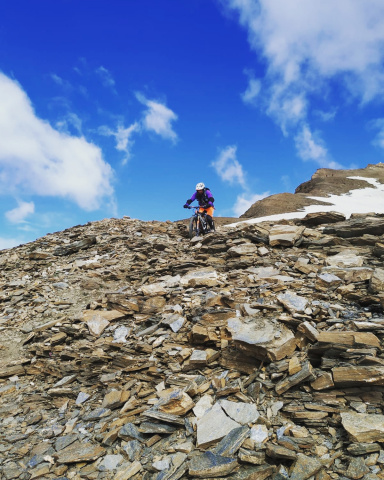
The descent is at times difficult, especially the first part, from Punta Caravina to the Medelet hut, the trail is also very exposed.
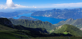
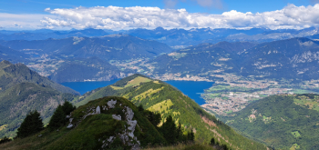
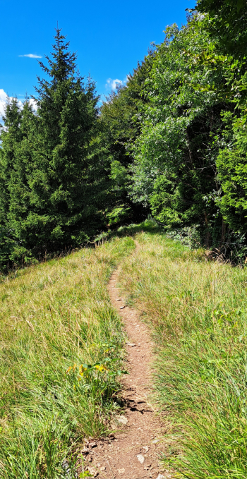
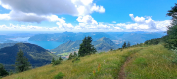
It starts from the large parking lot of the Pyramids, in Cislano, a hamlet of Zone (scratch-parking fee purchasable at the nearby kiosk, 2.00 euros all day) at an elevation of 600 meters. You ascend from the classic roadway up the Gasso Valley, passing Croce di Marone to the Guglielmo Superiore hut, 1740 meters. Here instead of turning right for the very steep cemented ramps that lead to the Almici refuge, go straight ahead, until you reach a fork, elevation 1780, climbing to the right you reach the malga Palmarusso di Sopra, 1840 meters. Here the roadway ends, now continue along a scenic, flat, good part pedalable trail to Punta Caravina, 1850 meters. Despite the name it has everything but the tip, it is a ridge, at the beginning of the summit ridges of the massif. The views are really great.
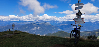
Changed trim now begins the descent to the Medelet refuge below. Pay attention to the first part very exposed and not always feasible on the pedals (S3 - S4). The descent is quite difficult and gives good satisfactions if you have a good and safe riding technique.
At the Medelet refuge you descend to the left (marker post with signs) along a somewhat steep, doable trail. At a first fork on the left signposted Roccolo Caravina you go straight ahead (this is a shortcut but the trail is very narrow, uphill, bad to do on a bike). Shortly below, at the junction with an almost flat trail you must turn left. You follow a long, eat-and-drink traverse trail with an uphill shoulder section (a few points, though easy are exposed) until you reach the ridge at Roccolo Caravina.
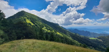
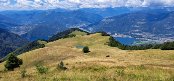
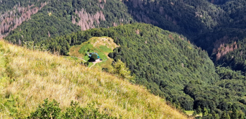
Continuing straight on would reach the Palmarusso refuge, connecting to the classic Uccellatori descent. Instead you turn right following the ridge with some up and downs (a few uphill parts a tad rough but really nice as well as scenic downhill sections). When the ridge widens quite a bit and becomes grassy you reach the Agolo locality near the 13 Plants. At an artificial puddle turn left following a small road to the nearby alpine hut. Here starts a traverse path a little eat and a little drink, which leads past Presel to the Culme farmsteads. Now return to the classic trail known as the Uccellatori trail, which through Paghera de Tres, passing by the little house in the rock, below Corno Frere, ends at Splazza di Sopra, in Val di Gasso, on the roadway traveled uphill (elevation 1000).
Go up only as far as after the first hairpin bend and take the old cobbled downhill road on the right, which further down skirts a hairpin bend in the roadway, to cross it again just below. Cross it by taking the path on the opposite side, which ends at the first hairpin bend of the roadway in question. Climb briefly to the next hairpin bend to take the last path that ends at the provincial roadway, opposite the parking lot.
Now an ice-cold beer at the nice kiosk surrounded by greenery at the gateway to the erosion pyramids is just what you need.