Italiano
 Deutsch
Alpe Motta e Gola del Cardinello

I'll premise right away that the degree of difficulty of almost the entire route is 1 star, while the difficulty of the section in the Cardinello Gorge soars to 4/5 stars for technical and exposed passages. Start from Isola in Val Chiavenna where you can park at the edge of the lake at the entrance to the village. Immediately quiet climb on Strada Vegia until intercepting the asphalt road to the village of Pianazzo. On secondary road we go up again and, avoiding passing through the tunnel, we arrive at the first houses of Madesimo where we turn right towards Alpe Motta. We still climb to the very crowded Lago Azzurro and the golden statue of the Madonna d'Europa placed in a panoramic position. Now up and down with short push-bike sections near the ski slopes.
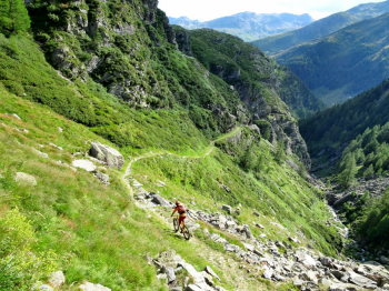
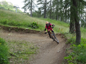
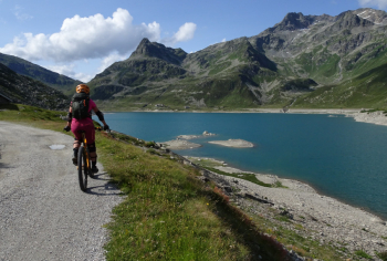
We lose altitude passing Alpe Groppera with its beautiful huts until we reach the arrival of the lifts assisting the Madesimo bike park. We reach the upper part of Madesimo going down the easy and fun descents of the Larici and Baloon bike park. With some challenging sections we reach the scenic and bucolic Andossi Plateau where we encounter frequent grazing animals and from where we descend to reach the Montespluga Reservoir. Up to now the itinerary is yes hard for the climbs but presents almost no degree of difficulty on the descent. Now the music changes with the Cardinello Gorge, an ancient communication route already known in Roman times and made important in the 1700s as it was traveled by traders, armies and smugglers.
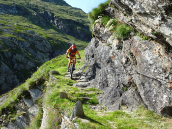
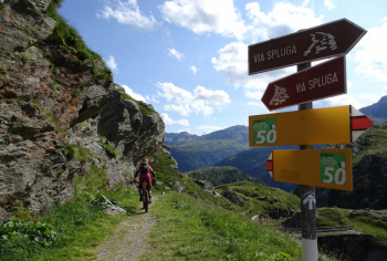
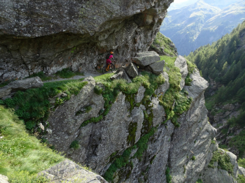
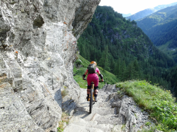
The trail that passes through the Cardinello Gorge is part of the Via Spluga and is a route carved into the rock that has some very exposed technical sections to be done with bike at your side.
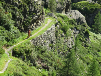
The trail is not narrow but because of the strong exposure it is not recommended for those who suffer from vertigo. We are descending left side of the valley and, having finished the exposed section, we arrive at a junction where the Via Spluga passes on the other side. From news collected on the net, the right side is not totally cyclable and it is a continuous up and down from the bike. For this reason we ignore the detour and continue down the left side of the Gorge towards Torni where we lose altitude on a very easy grass path. From Torni to the parked car at Isola is a moment.
Hike to be done in good weather and not on summer weekends as the trail down into the Cardinello Gorge is very busy with hikers who are following the Via Spluga.