Italiano
 Deutsch
Passo del Baldiscio

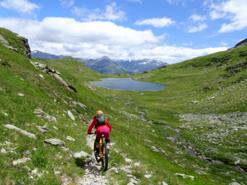
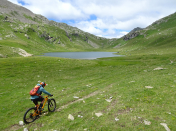
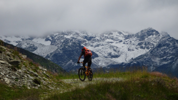
Excursion with destination the Baldiscio Pass at 2353 m altitude on the border between Val Chiavenna and Swiss Val Mesolcina. The start is from the village of Isola in the municipality of Madesimo (SO) where on asphalt with zero traffic at the beginning and then on a nice dirt road we immediately gain elevation passing through several villages (Canto, Cà Raseri, Stabisotto). Arriving near the nucleus of Borghetto begins a stretch of about 400 meters of elevation gain where the cyclability is practically nil and we will have to alternate between pushing and back-cycling stretches. In this stretch of passion it is worth memorizing the trajectories we will follow when we retrace this part of the trail downhill.
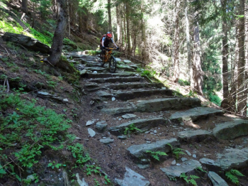
Once we pass in succession Lake Grande del Baldiscio and Lake del Mot, we will have arrived at our destination. Up the guards and we are ready to retrace downhill the beautiful trail we took uphill to the first houses of Borghetto. At the end of the houses the trail that descends into Val Febbraro starts. Initially this trail starts out flowing and will deceive you that the descent will be a piece of cake. Nothing of the sort, the trail soon becomes very technical and there will be several staggered sections to overcome that will have to be taken with the utmost care.
The technical trail ends on the easy Val Febbraro dirt road, which we will walk along in relaxation until we intercept the trail that descends to Isola where we will need to pay close attention to the stones placed across the trail to divert rainwater downstream. At Isola the hike ends.
PS: The 400-meter elevation gain section with bike on your back will be replaced by a bike path that will lead up to a new Refuge (practically already completed) located near Lake Grande del Baldiscio.
Please refer to the photoreport for more information.