Italiano
 Deutsch
Adamè, le scale estreme ed il rifugio Città di Lissone
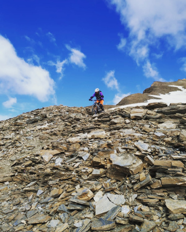
Absolutely DANGEROUS out-and-return cyclo-mountaineering route for the few with excellent and safe riding technique. The aim is to tackle the "extreme" descent of the so-called Adamè Stairs. Difficulty S4 with short sections of S5, WARNING, really DIFFICULT with several EXPOSED sections, the wooden railing, not always present, gives a "tranquility" more than anything else psychological. I biked down it about 80% of the way.
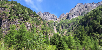
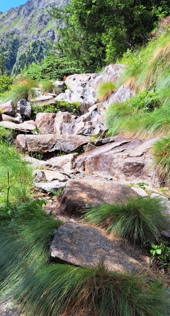
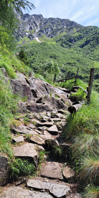
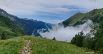
We are in the Adamello massif, the majestic Val Adamè is one of the glacial valleys that originate from the Pian di Neve, after an initial long groove that slopes gently, with little gradient, at an altitude of 2,000 it precipitates almost vertically for 400 meters to the 1,600 of malga Lincino. It is along this escarpment that the path has been built to overcome the imposing precipice. The start is in the hamlet of Valle in the commune of Saviore dell'Adamello (one could start from further down but it would add nothing as there is no path to ride downhill, one could also start from higher up but wanting to pedal a minimum it is recommended to start from there), parking on the left at the end of the village, at the top.
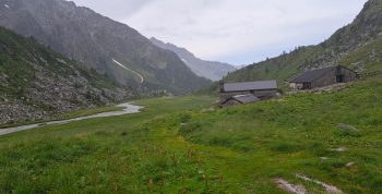
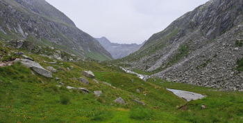
Pedal along asphalt road to malga Lincino. From here the trail begins. After a hundred or so meters you relentlessly shoulder the bike for 400 meters of elevation gain, taking advantage of the trudge to study the descent route. At 2,000 meters the trail finally flattens out and we can now pedal, climbing up the beautiful, low-slung upper Adamè Valley to near the Adamè Hut (a few steps on foot, bog).
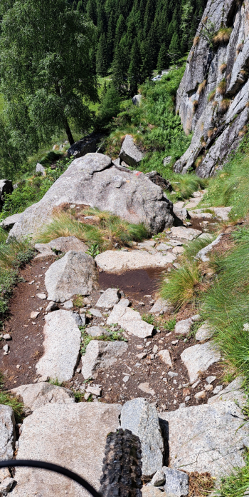
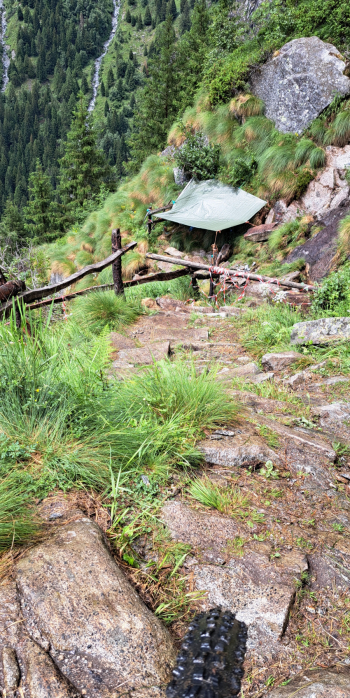
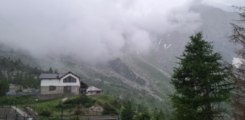
On the descent we retrace the path and at the height of the artificial lake a very short detour is a must to reach the Città di Lissone refuge, 2020 meters, where it is possible to enjoy the exquisite hospitality of Fabio and Silvia, as well as the excellent home cooking. Resuming the descent, it is time to tackle the hostile, scurvy, granitic, super-technical, very physical trail that plunges 400 meters to the meadow clearing of malga Lincino. Our skill and nerves will now be put to a very hard test. Much ATTENTION must be taken, steep, EXPOSED, DANGEROUS stretches, two or three, short without protection with hairpin bends (the latter I tackled on foot in order to avoid almost certain suicide).
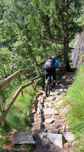
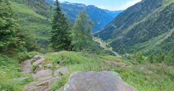
Back on the bitumen, just below the hut, we walk it about 200 meters until we locate a path to the left that cuts the subsequent hairpin bends (despite rocks and roots, even wet, we will find this one relaxing compared to the previous one. Back on the bitumen, at the end of the hairpin bends we just have to follow it to the Rasega locality. Here we can decide whether to continue on the asphalt to the car or turn left along a small natural-bottomed road to below the houses of Valle where a short climb brings us back to the village and the starting point.
 l
l