Italiano
 Deutsch
Rifugio Fallere da Saint Nicolas - giro ad anello orario

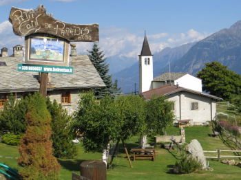
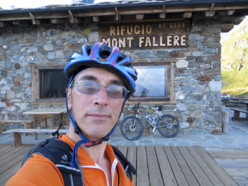
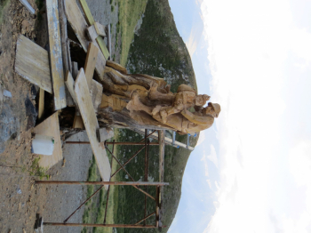
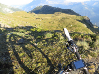
Departure from Saint Nicolas (1,200 m) with destination the Refuge Mont Fallère (2586 m) above Aosta, on the side opposite the valleys of Cogne, Rhemes, Valsavarenche and Valgrisenche. It climbs initially on asphalt to the village of Chaillod, at the end of which you take a path on the left that allows you to avoid some bitumen and approach Gerbore and then Vetan where, not surprisingly, there is an agritourism with the inviting name Petit coin de paradis. At Vetan dessous there is one of the countless fountains; at Vetan dessus the trail starts on foot (trail 13) or by mtb, at an altitude of about 1700. The dirt road is a wide, firm-bottomed dirt road that reaches first the Chatalanez locality and then Grand Arpilles to continue on the path shared by hikers and share with them the beauty and variety of the wooden sculptures along the last 3 kilometers to the Fallere refuge. We meet the ibex, lizard, crow, fox, grandfather and grandchildren, ski jumper, and shepherd boy looking out from behind a stone. The hut is large and cozy.
From the Refuge begins the descent that initially is technical, then arrived on the dirt road that also crosses the path that comes from Lake Fallere, you face a slight up and down on the slopes of Beccafrance, then entering the woods, it becomes smooth and the single track runs on a bed of pine needles with many fun tight hairpin bends. Reaching the village of Vetan you can not be fascinated by the unique panorama that opens on the Gran Paradiso in fact, from here it is easy to identify the 3 valleys (Val di Cogne, Valsavarenche, Val di Rhemes) that make up the Massif. We cross Vetan on asphalt, at the height of a hairpin bend-where there is also a small church-we take the path again, which first downhill then on a false level takes us to close the hour loop at Saint Nicolas.