
 Italiano
 Deutsch
2025/04/29 19:15:23
Alta via di Appiano da Merano
Author

Place
Italy - Trentino-Alto Adige/Südtirol, BZ
Km
65,11 km
Elapsed time
05:10:38
Vertical meters
+1 800 mt (257 - 1292)
Route difficulty
Landscapes
Last update
2025/04/30 07:08:53
Comments
Description
Fairly challenging route due to rather steep climbs, but with no difficult trails, it could almost be called a gravel route, since it takes place almost entirely on secondary dirt or paved roads.
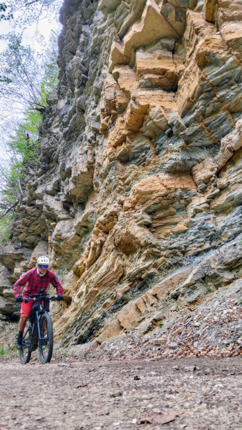
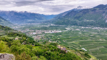
In any case beautiful views of the Adige valley and the ancient little churches that are encountered along the way.

During the tour numerous opportunities for refreshments at typical farms.
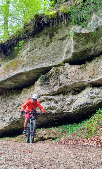
From Merano it is 65 km and 1800 meters of elevation gain; if necessary you can start from Lana.
Local weather
Today

27 °C
Tonight

17 °C
Tomorrow

24 °C
Tomorrow night

17 °C
Tuesday
22 °C
Tuesday night

13 °C


Graph
Nearest Routes
94,24 km
Km
+2 400 mt
Vertical meters
Route difficulty
Landscapes
2023/03/04
- Italy - Trentino-Alto Adige/Südtirol, BZ 58,93 km
Km
+3 000 mt
Vertical meters
Route difficulty
Landscapes
52,87 km
Km
+1 754 mt
Vertical meters
Route difficulty
Landscapes
105,14 km
Km
+3 200 mt
Vertical meters
Route difficulty
Landscapes
43,62 km
Km
+1 615 mt
Vertical meters
Route difficulty
Landscapes
93,54 km
Km
+2 520 mt
Vertical meters
Route difficulty
Landscapes
33,38 km
Km
+1 600 mt
Vertical meters
Route difficulty
Landscapes
48,57 km
Km
+1 550 mt
Vertical meters
Route difficulty
Landscapes
61,03 km
Km
+2 156 mt
Vertical meters
Route difficulty
Landscapes
37,99 km
Km
+1 520 mt
Vertical meters
Route difficulty
Landscapes