
 Italiano
 Deutsch
Tetê de Blanche de By (3429 metri)

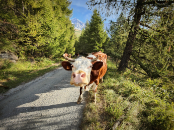
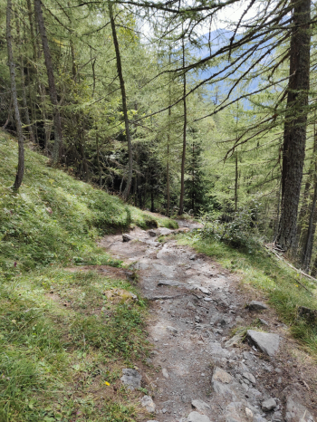
Fantastic mountaineering cycle tour, only for connoisseurs; 600 meters of elevation gain pedaled and 1500 backpacked for a fantastic descent immersed in the 4000s of the Aosta Valley. Start from Vaud in small parking lot. We climb the first 300 meters on not very comfortable bottom with 20-30% gradient. We continue with comfortable traverse for the last 200 meters pedalable (last free water points).
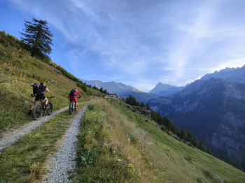
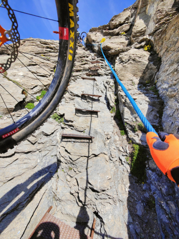
We continue to the third camune alpe on partly pedalable path (with a very good leg). From the alpe it's bike-only all the way to the top, sometimes it's possible to alternate some pushing sections but the trail is not too comfortable and it's better to keep the bike on the shoulder. We come to the most difficult section of the climb, which for those familiar with alpine rides will not be too complicated but it is still worthwhile to pay proper attention and tie the bike well on the shoulder. It is a stretch of about 50 meters of which 20 are equipped with rope and steel steps.
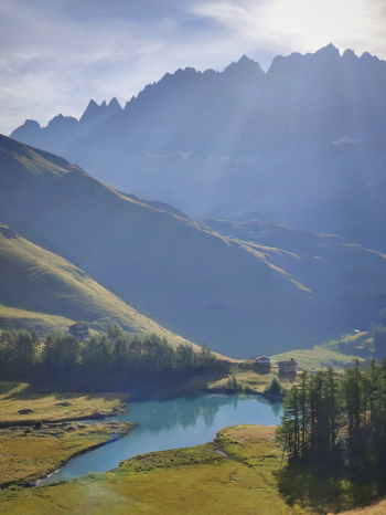
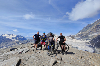
We pass the Rifugio Chiarella hut at Amianthe, where we received fastastic hospitality. We continue by shoulder and push to the summit. Tete Blanche de By, 3413 meters, surrounded by the 4000 meters of the Val'Aosta Pure spectacle!
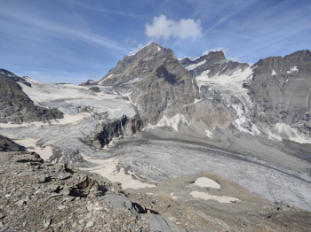
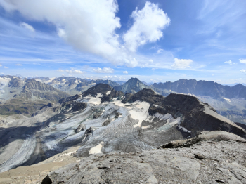
Before descending we preoseguiamo slightly off trail to another fantastic viewpoint. Descent to the refuge on scree, 400 meters S1/S2 and a few technical passages S3/S4. From the refuge we return to the equipped section. On the descent it is slightly more complicated, personally I helped myself by blocking the brakes with tape. From here the descent is a not too wide single track all to take it easy with lots of S3/S4 passes and numerous nose presses. From the third camune alp we continue on a fast S2 to the low road. We veer left to take the last descent, which is beautiful and exciting and alternates between S2 sections and several gudorous S3 and S4 passages.
Trail style: AM
Personal rating: 9/10
MTB: yes
EMTB: not recommended (although I did it with a light and there was also one with a full)
Duration about 7h
Portage: yes about 1500m
Exposure: Short 50m section with canapone and steps
Difficulty ascent: first 300m with 25% gradient
Difficulty descent: 1st descent 400m S1/S2; 2nd descent 1350m S3+; last 600m S3
Drainage: the bottom seems definitely draining
Water points at elevation 2000 (well before alpe camune) or at the refuge (if open)


