
 Italiano
 Deutsch
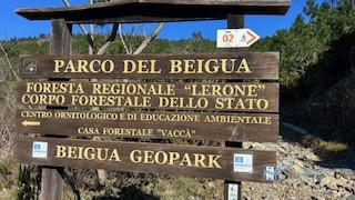
Arenzano - X-Rossa, Guretto e V-Bianca

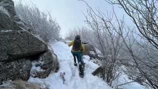
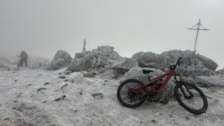
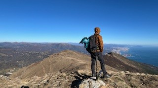
Second day in Liguria of the long weekend that began with Monte Carmo and continues on the Arenzano trails, always looking for the most technical trails in the area, maximizing the negative elevation gain. So we start with a transfer made by Marco Besutti of www.seifuori.it that takes us from Arenzano to the forest road that goes up to the Faiallo Pass, leaving us at the 'Nuvola sul Mare'. The weather is not the best, a very strong wind brings the thermal zero definitely below 0 degrees, but we set off along the AV that through a snowy trail often pedaled by e-bike leads us in short time to the top of Monte Reixa (1,183 meters). Here begins a descent on a very technical and physically demanding trail mostly on fixed rock, which due to ice and snow is only partially rideable. The first part of the very technical descent ends at Passo Della Gava (752 meters). From the pass begins an uphill trail that requires us to push the bike and allows us to reach Tardia Pass (860 meters), a flat saddle separating the Tardia di Levante and Tardia di Ponente peaks over which we will pass in the afternoon.
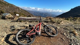
From the pass begins the superb X RED, initially on a non-technical trail until we reach a bend that passes under rocky ridges and exposed points that require great care. Past these passages, in my opinion the most beautiful of the day, the trail continues to the Casa del Dazio and then continues on a very technical and rocky path that leaves little respite until just below Monte Bricco Grosso (441 meters) from where, with a small transfer on an uphill cart track, we reach the next SUGARSU descent that begins in front of a house. The path has some very enjoyable artificial passages, including overcoming an imposing rock with a wooden construction that facilitates access; it has recently been cleaned up and arranged with a new way out that avoids fording a stream and ending up on a road that is now disused because it is completely collapsed and unsafe; it ends at an underpass of the A10 from where we descend to Vesima.
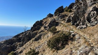
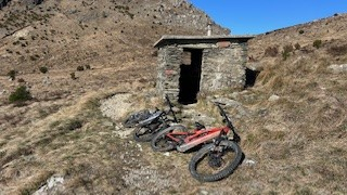
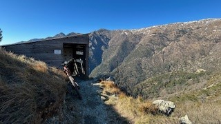
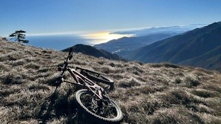
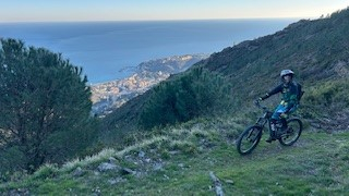
From Vesima the transfer takes us to the Curlo parking lot from where we take the forest road that climbs to Passo della Gava (750 meters). The forest road is very bumpy with numerous chasms that often force you to push. From the pass you push up with the Diretta to Monte Tardia di Ponente (928 meters) from where, admiring the majestic landscape over Genoa and the surrounding mountains, the GURETTO TRA IL descent begins , a very technical trail with trialistic sections and constant views of the sea, never too steep, but always difficult and where the rock both loose and fixed and sharp does not give you breath. The trail descends first to Passo della Gavetta (715 meters) and then to Cima Rianin (600 meters) and ends just below Cima Brusca (480 meters), where you have to turn left to climb to Rifugio Scarpeggin (500 meters) on a very scenic and entirely rideable trail.
From the hut more ascent to the pass (550 meters) where the descent V BIANCA PARTE BASSA, the most technical and difficult descent in the area, starts, descending to Ca Bugioa (170 meters). We are left with the regret that we did not do the V-WHITE in its entirety; it will be for next time. We close the tour with the Sentiero degli Inglesi, entirely rideable with which we end the day saturated with adrenaline and immense satisfaction.
 S
S


