2022/10/11 20:47:03
Periplo Testa di Comagna
Author
Place
Italy - Valle d'Aosta, AO
Km
25,12 km
Elapsed time
05:14:26
Vertical meters
+1 122 mt (635 - 1641)
Route difficulty
Landscapes
Last update
2023/01/03 16:09:56
Comments
Description
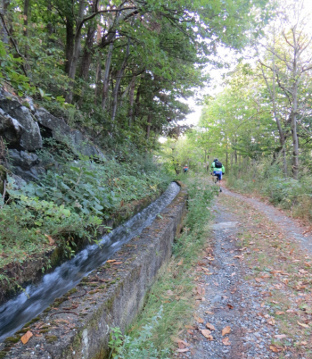
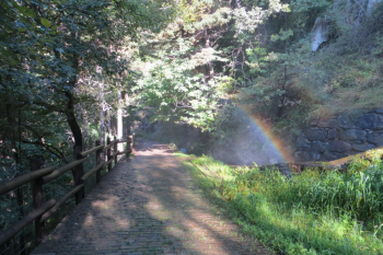
Counterclockwise tour of Testa di Comagna through 3 hills. From Cillian (620 m) to Col d'Arlaz (1060 m.) along Ru d?Arlaz, an old stone irrigation canal marked as trail No. 3, and continue to Orbeillaz. From here the asphalt road to Col Tzecore begins, crossing the path to the Bechaz mines. In front of the picnic area of Col Tzecore, take a path on a false level, arrive at Sommarese, keep above the hamlet and continue to Col de Joux and the Pallù pond. From the pond descend by trail a few hundred meters and, at the fork before the forest, continue right on trail 7 Feilley-Salirod to cut the Col de Joux road through the hamlets of Salirod, Lenty and back to Cillian.


Local weather

°C

°C

°C

°C

°C

°C
Graph
Nearest Routes
26,19 km
Km
+2 200 mt
Vertical meters
Route difficulty
Landscapes
22,09 km
Km
+1 233 mt
Vertical meters
Route difficulty
Landscapes
2022/10/18
- Italy - Valle d'Aosta, AO 31,51 km
Km
+2 400 mt
Vertical meters
Route difficulty
Landscapes
33,54 km
Km
+1 450 mt
Vertical meters
Route difficulty
Landscapes
27,80 km
Km
+2 099 mt
Vertical meters
Route difficulty
Landscapes
2022/09/04
- Italy - Valle d'Aosta, AO 32,99 km
Km
+1 458 mt
Vertical meters
Route difficulty
Landscapes
47,61 km
Km
+2 400 mt
Vertical meters
Route difficulty
Landscapes
28,72 km
Km
+1 121 mt
Vertical meters
Route difficulty
Landscapes
2022/09/16
- Italy - Valle d'Aosta, AO 45,84 km
Km
+2 206 mt
Vertical meters
Route difficulty
Landscapes
2024/05/08
- Italy - Valle d'Aosta, AO 32,97 km
Km
+1 521 mt
Vertical meters
Route difficulty
Landscapes


 Italiano
 Deutsch