HOME RANKINGS CHALLENGES ROUTES POI PLANNING SEARCH LOGIN
Italy - Valle d'Aosta, AO
2022/09/05 20:35:53

Brusson - Palasina Lakes - trail 4

2 Downloads
1
 
Author
gmzolenart
(104)
Place
Italy - Valle d'Aosta, AO
Km
22,09 km
Elapsed time
04:17:39
Vertical meters
+1 233 mt (1240 - 2442)
Route difficulty
Landscapes
Last update
2022/10/03 21:11:08
Comments
0
Description

From the center of Brusson, follow the asphalt road that leads to Estoul, in an hour 550 mt disliv for 7 km.

From Estoul follow the dirt road that leads, at the top of the lifts, following the signs to Rifugio Arp (the fountains are in Brusson, before Estoul, at the beginning of the dirt road at the junction between pedestrian and mule track sent.).

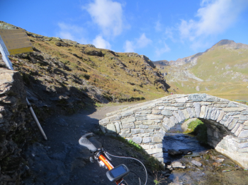
When you reach the plateau after skirting the slopes of Bieteron, take the lakes of Palasinaz and Corno Bussola on the left, then leaving the Refuge on the right.

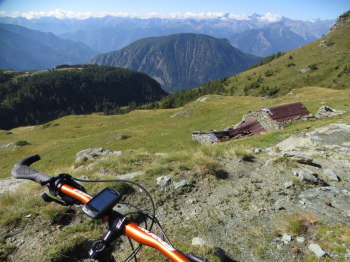
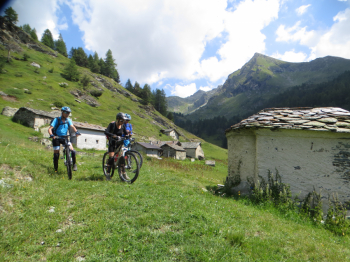
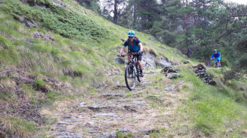
This is followed by a climb to the end of the dirt road and after 50m of biking on your back you reach higher plateaus and the various Palasina Lakes. The descent by trail No. 4 has no signposts: one must turn left at the small bridge at the beginning of the lake and follow a barely hinted trail back to the beginning of the portage. Then follow a more defined trail keeping to the right of the upper Palasina alpine meadow; when you reach the stream, do not cross it, but descend through meadows to the abandoned hamlets of Chavanne and Merendioux. Continue on to a mule track to be followed downhill arriving at Lavassey. Now I begin the most beautiful part of sent.4, a trail with fixed stones up to a dirt road beyond which the trail continues wider to 'asphalt a short distance from Brusson.

Hiker's Editor No. 8 Trail map 1:25000 Alte vall d'Ayas e del Lys Monte Rosa.


Download our free mobile app to send this route to your Garmin device or to navigate it on OSM maps. Android - iOS

Graph

Nearest Routes

31,51 km
Km
+2 400 mt
Vertical meters
Route difficulty
Landscapes
2023/07/12
- Italy - Valle d'Aosta, AO
gmzolenart
(104)
26,22 km
Km
+950 mt
Vertical meters
Route difficulty
Landscapes
2022/10/11
- Italy - Valle d'Aosta, AO
gmzolenart
(104)
25,12 km
Km
+1 122 mt
Vertical meters
Route difficulty
Landscapes
2022/08/22
- Italy - Valle d'Aosta, AO
nonnocarb
(266)
17,25 km
Km
+700 mt
Vertical meters
Route difficulty
Landscapes
2022/08/22
- Italy - Valle d'Aosta, AO
nonnocarb
(266)
19,82 km
Km
+989 mt
Vertical meters
Route difficulty
Landscapes
2022/08/22
- Italy - Valle d'Aosta, AO
nonnocarb
(266)
22,30 km
Km
+468 mt
Vertical meters
Route difficulty
Landscapes
2022/08/06
- Italy - Valle d'Aosta, AO
gmzolenart
(104)
16,23 km
Km
+931 mt
Vertical meters
Route difficulty
Landscapes
2022/12/22
- Italy - Valle d'Aosta, AO
gmzolenart
(104)
19,73 km
Km
+1 385 mt
Vertical meters
Route difficulty
Landscapes
2022/11/07
- Italy - Valle d'Aosta, AO
paiogs
(12)
25,85 km
Km
+2 100 mt
Vertical meters
Route difficulty
Landscapes
2022/10/02
- Italy - Valle d'Aosta, AO
BAROLO71
(33)
14,78 km
Km
+1 000 mt
Vertical meters
Route difficulty
Landscapes

0 Comments