HOME RANKINGS CHALLENGES ROUTES POI PLANNING SEARCH LOGIN
Italy - Valle d'Aosta, AO
2024/11/06 16:50:20

Pila Bike Park

0 Downloads
0
 
Share
Author
Paoloc1
(61)
Place
Italy - Valle d'Aosta, AO
Km
39,20 km
Elapsed time
-6:-4:-15
Vertical meters
+2 160 mt (593 - 2274)
Route difficulty
Landscapes
Last update
2024/11/07 08:50:02
Comments
0
Description

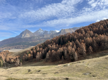
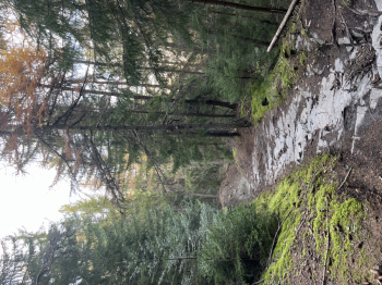
Pila Bike Park, pistini and more.You start from the bottom (Gressan 620 meters) and go up to Pila by a quiet forest road (first asphalt section and then dirt) with medium gradient and all well pedalable but very long, and you reach Pila (1800 meters).Here you take a service road that climbs quite gradually in hairpin bends until you reach the Chamolè mountain station (2310 meters). From here start the most beautiful and spectacular little pistes, I chose the Red 4 that goes down to Pila. It is a perfect little pistino: parabolics, jumps, steep wall rides and everything perfectly connected like a bobsleigh track! In Pila you go back up the usual service road, but about halfway up you keep to the right for the Grimondet alpine road until you reach an alpine hut where trail 08_T26 (black according to TrailForks) starts. It's actually a nice track on a mountain trail with steps, steep steeps on dirt and stone, firm boulders, technical but never extreme passages.

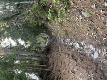
At the end in the locality of Brin Dessus, we keep left and follow a fun single track (Fantasy Land) that with countless ups and downs in the forest takes us to the locality of Turnin.Here you follow the forest road towards Pila slightly uphill and when you arrive at a house you go down a hairpin bend and take trail 21B (black). A nice technical single track with steps, firm stone a few sections of nice rocky mule track, steep steeps, passages on briars, all very clean and doable, but not trivial. A descent of 1000 meters of elevation gain that in the final part follows the leftmost track (21d) that arrives on the asphalt road and from here to the right in a short time you arrive at the starting parking lot.
Download our free mobile app to send this route to your Garmin device or to navigate it on OSM maps. Android - iOS
Local weather
Today
7 °C
Tonight
2 °C
Tomorrow
9 °C
Tomorrow night
-1 °C
Wednesday
9 °C
Wednesday night
1 °C
Thursday
11 °C
Thursday night
-1 °C
Friday
8 °C
Friday night
-3 °C

Graph

Nearest Routes

2024/06/27
- Italy - Valle d'Aosta, AO
marco
(129)
37,94 km
Km
+2 399 mt
Vertical meters
Route difficulty
Landscapes
2022/10/24
- Italy - Valle d'Aosta, AO
69,26 km
Km
+1 967 mt
Vertical meters
Route difficulty
Landscapes
2023/09/12
- Italy - Valle d'Aosta, AO
ebsat
(108)
31,30 km
Km
+2 574 mt
Vertical meters
Route difficulty
Landscapes
2022/08/22
- Italy - Valle d'Aosta, AO
nonnocarb
(292)
17,77 km
Km
+1 079 mt
Vertical meters
Route difficulty
Landscapes
2023/08/05
- Italy - Valle d'Aosta, AO
37,61 km
Km
+800 mt
Vertical meters
Route difficulty
Landscapes
2022/09/04
- Italy - Valle d'Aosta, AO
gmzolenart
(115)
29,77 km
Km
+1 356 mt
Vertical meters
Route difficulty
Landscapes
2022/10/03
- Italy - Valle d'Aosta, AO
gmzolenart
(115)
18,80 km
Km
+1 062 mt
Vertical meters
Route difficulty
Landscapes
2023/08/07
- Italy - Valle d'Aosta, AO
24,43 km
Km
+1 450 mt
Vertical meters
Route difficulty
Landscapes
2023/07/31
- Italy - Valle d'Aosta, AO
Staff
(77)
19,82 km
Km
+1 030 mt
Vertical meters
Route difficulty
Landscapes
2023/06/10
- Italy - Valle d'Aosta, AO
marco
(129)
7,95 km
Km
+141 mt
Vertical meters
Route difficulty
Landscapes

0 Comments