HOME RANKINGS CHALLENGES ROUTES POI PLANNING SEARCH LOGIN
Italy - Trentino-Alto Adige/Südtirol, BZ
2024/10/10 21:23:55

Rifugio del Valico

34 Downloads
1
 
Share
Author
Staff
(77)
Place
Italy - Trentino-Alto Adige/Südtirol, BZ
Km
29,33 km
Elapsed time
04:45:49
Vertical meters
+1 650 mt (222 - 1856)
Route difficulty
Landscapes
Last update
2024/10/10 21:24:40
Comments
0
Description

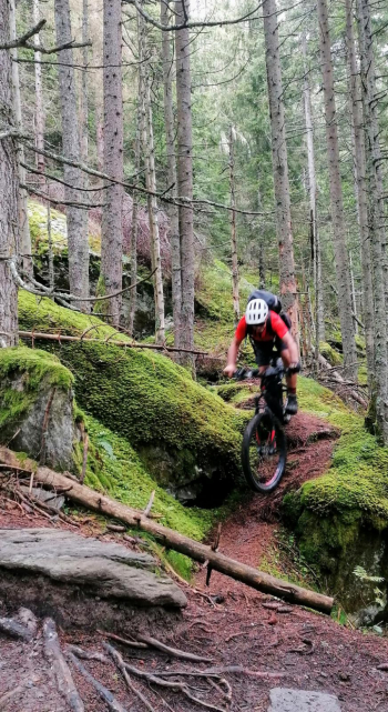
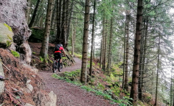
A very challenging route, both for the long, steep climb, with pushing sections, up to the hut, and for the descent, steep technical and difficult from start to finish, without a moment's respite, but also a lot of fun for those with good descent technique and a bike with adequate suspension. On the ascent we try to avoid as much as possible the asphalt with challenging cuts, although a long part cannot be avoided. When you then arrive at the Leiter Alm (refreshment hut), you have to do a section with your bike on your back; the rest of the trail up to the Pass is all up and down from the bike, but a bit more pedalable.

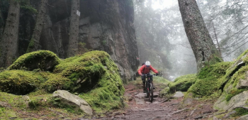
When you get to the Valico hut (refreshment) though, you are rewarded for all your efforts and can rest on the large meadows or benches with beautiful views of the Alps and Dolomites. Now 1500 meters of elevation gain await us on Trail 7, all technical and challenging to know how to interpret in order to also have fun. After a short asphalt section, again a fun slightly downhill trail, a connecting section and a last trail bring us back to Merano. Ideal for bikers with bikes from the abundant excursions.
Download our free mobile app to send this route to your Garmin device or to navigate it on OSM maps. Android - iOS
Local weather
Today
6 °C
Tonight
-1 °C
Tomorrow
10 °C
Tomorrow night
4 °C
Monday
11 °C
Monday night
7 °C
Tuesday
12 °C
Tuesday night
7 °C
Wednesday
12 °C
Wednesday night
6 °C

Graph

Nearest Routes

2024/09/18
- Italy - Trentino-Alto Adige/Südtirol, BZ
nonnocarb
(292)
59,35 km
Km
+3 050 mt
Vertical meters
Route difficulty
Landscapes
2023/03/07
- Italy - Trentino-Alto Adige/Südtirol, BZ
nonnocarb
(292)
33,38 km
Km
+1 600 mt
Vertical meters
Route difficulty
Landscapes
2023/03/01
- Italy - Trentino-Alto Adige/Südtirol, BZ
nonnocarb
(292)
61,03 km
Km
+2 156 mt
Vertical meters
Route difficulty
Landscapes
2022/11/21
- Italy - Trentino-Alto Adige/Südtirol, BZ
nonnocarb
(292)
41,95 km
Km
+1 783 mt
Vertical meters
Route difficulty
Landscapes
2022/10/22
- Italy - Trentino-Alto Adige/Südtirol, BZ
nonnocarb
(292)
65,78 km
Km
+2 336 mt
Vertical meters
Route difficulty
Landscapes
2023/03/01
- Italy - Trentino-Alto Adige/Südtirol, BZ
nonnocarb
(292)
53,70 km
Km
+1 570 mt
Vertical meters
Route difficulty
Landscapes
2023/03/05
- Italy - Trentino-Alto Adige/Südtirol, BZ
nonnocarb
(292)
93,54 km
Km
+2 520 mt
Vertical meters
Route difficulty
Landscapes
2024/08/25
- Italy - Trentino-Alto Adige/Südtirol, BZ
nonnocarb
(292)
61,04 km
Km
+2 300 mt
Vertical meters
Route difficulty
Landscapes
2023/03/01
- Italy - Trentino-Alto Adige/Südtirol, BZ
nonnocarb
(292)
76,06 km
Km
+2 300 mt
Vertical meters
Route difficulty
Landscapes
2024/08/22
- Italy - Trentino-Alto Adige/Südtirol, BZ
nonnocarb
(292)
74,92 km
Km
+2 500 mt
Vertical meters
Route difficulty
Landscapes

0 Comments