HOME RANKINGS CHALLENGES ROUTES POI PLANNING SEARCH LOGIN
Italy - Valle d'Aosta, AO
2024/06/27 09:51:42

Da Aosta a La Salle - All Around EMTB 2024 giorno 1

175 Downloads
6
 
Share
Author
marco
(124)
Place
Italy - Valle d'Aosta, AO
Km
37,94 km
Elapsed time
00:00:00
Vertical meters
+2 399 mt (573 - 2299)
Route difficulty
Landscapes
Last update
2024/07/15 16:39:27
Comments
2
Description

Itinerary done by ebike, also doable by bike if you ride the first 800 meters of elevation gain uphill from Sarre to Verrogne on the paved road and not on the steep trail of the track. In fact this trail is already quite a challenge with a full power ebike, especially the first few ramps. The bottom with cobblestone parts becomes slippery in wet weather, as happened to us, making some points quite difficult to do in the saddle. In any case, this is a real ebike climb, fun and rewarding. In Vetan we stopped for something to eat and recharged our batteries for about half an hour, the owners of the restaurant are very friendly and the outlets are out beside the entrance.

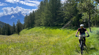
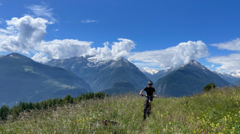
An up and down section on trail followed, with phenomenal views, before we began the magnificent descent on forest floor to the valley floor near Clapion where the last climb of the day on a comfortable dirt road begins. Arriving at the top, we couldn't resist the trail to Punta Fetita. We stopped on an anticima and from there enjoyed a beautiful ridge descent. Descent that is just the beginning of the one that will take us to La Salle, first on beautiful meadows, then on another fun trail unfortunately interrupted by some aqueduct work that widened it with a havoc to put down a water pipe.

The character of the trail changes the closer you get to La Salle, becoming drier, with a stony bottom and several stone channels on which to be careful not to puncture as happened to us.

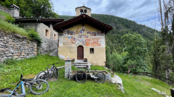
For the return from La Salle you can follow the road to Aosta, we had 2 cars to avoid the stretch on asphalt. This is the first stage of theAllAround EMTB 2024.

#allaround


Download our free mobile app to send this route to your Garmin device or to navigate it on OSM maps. Android - iOS
Local weather
Today
20 °C
Tonight
10 °C
Tomorrow
20 °C
Tomorrow night
9 °C
Sunday
20 °C
Sunday night
11 °C
Monday
16 °C
Monday night
8 °C
Tuesday
19 °C
Tuesday night
7 °C

Graph

Nearest Routes

2022/10/24
- Italy - Valle d'Aosta, AO
69,26 km
Km
+1 967 mt
Vertical meters
Route difficulty
Landscapes
2023/09/12
- Italy - Valle d'Aosta, AO
ebsat
(106)
31,30 km
Km
+2 574 mt
Vertical meters
Route difficulty
Landscapes
2022/08/22
- Italy - Valle d'Aosta, AO
nonnocarb
(287)
17,77 km
Km
+1 079 mt
Vertical meters
Route difficulty
Landscapes
2022/09/04
- Italy - Valle d'Aosta, AO
gmzolenart
(110)
29,77 km
Km
+1 356 mt
Vertical meters
Route difficulty
Landscapes
2023/08/05
- Italy - Valle d'Aosta, AO
37,61 km
Km
+800 mt
Vertical meters
Route difficulty
Landscapes
2023/08/07
- Italy - Valle d'Aosta, AO
24,43 km
Km
+1 450 mt
Vertical meters
Route difficulty
Landscapes
2023/07/31
- Italy - Valle d'Aosta, AO
Staff
(73)
19,82 km
Km
+1 030 mt
Vertical meters
Route difficulty
Landscapes
2023/06/10
- Italy - Valle d'Aosta, AO
marco
(124)
7,95 km
Km
+141 mt
Vertical meters
Route difficulty
Landscapes
2022/10/03
- Italy - Valle d'Aosta, AO
gmzolenart
(110)
18,80 km
Km
+1 062 mt
Vertical meters
Route difficulty
Landscapes
2022/08/22
- Italy - Valle d'Aosta, AO
nonnocarb
(287)
14,66 km
Km
+693 mt
Vertical meters
Route difficulty
Landscapes

2 Comments