HOME RANKINGS CHALLENGES ROUTES POI PLANNING SEARCH LOGIN
Italy - Trentino-Alto Adige/Südtirol, BZ
2024/05/08 15:38:38

Sella Ronda sulla neve

4 Downloads
0
 
Share
Author
nonnocarb
(284)
Place
Italy - Trentino-Alto Adige/Südtirol, BZ
Km
43,35 km
Elapsed time
-476118:-3:-15
Vertical meters
+2 300 mt (1536 - 2288)
Route difficulty
Landscapes
Last update
2024/05/09 14:12:44
Comments
0
Description

Tour of the 4 passes or Sella Ronda.

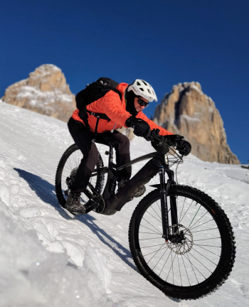
Over the years I've done it in all manners, on skis, on a snowboard, on a road bike on asphalt, and on an off-road mtb (two rides in one day with 5000+, but that's another story ?).

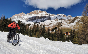
I was left with another way to do the Sella Ronda, something no one had done yet, and that tickled me quite a bit. The 4 passes by bike, but on snow!

I had been thinking about it for several years, only it needed a near-perfect "astral conjunction" to make it happen, i.e., slopes and lifts closed and snow still cold and rideable. The problem is that by the time the lifts close, usually in April, the snow is almost melted and what snow remains is spring. Here at last, this year, this late winter tail end allowed the dream to come true: ski lifts closed, slopes still groomed and temperatures well below zero!

April 25, 2024, I wake up at 5:30 a.m., take out all my winter clothing, and at 7 a.m. I am ready to leave Selva val Gardena in minus 7 degrees. First all-snow ascent to the Sella pass, with magnificent views of the Sassolungo. Descent on virgin slope to Lupo Bianco.

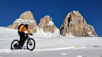
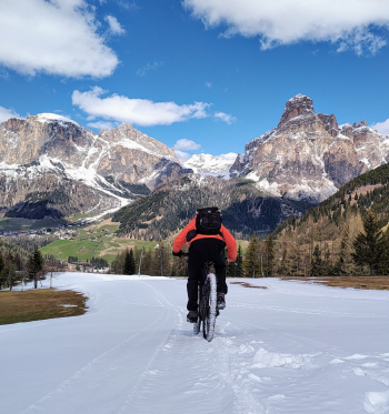
Snow ascent to Pordoi pass and very long white descent to Arabba. Here the slope is too steep, so I go up on asphalt to Campolongo Pass, where a patrol of carabinieri on Ducati compliments me ?.

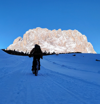
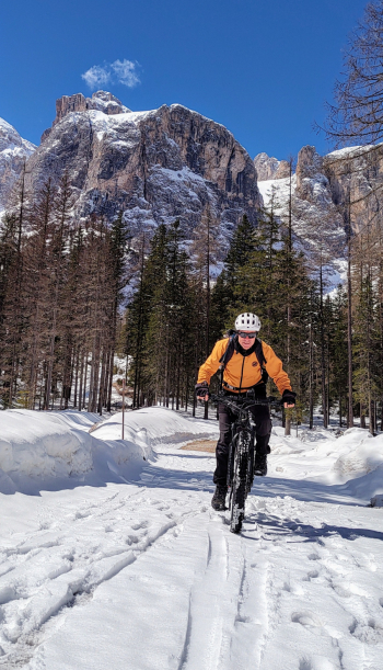
Snowy descent to Corvara, first part of the climb to Passo Gardena in the snowy forest to the Pisciadù waterfalls and then on asphalt to the pass.

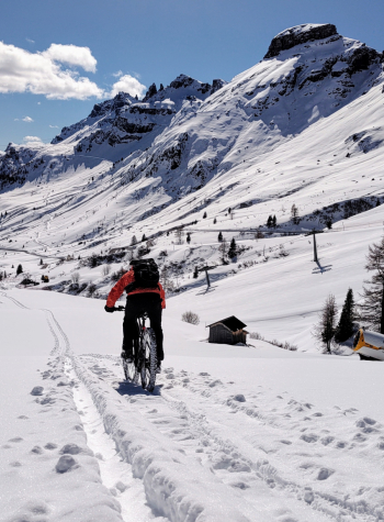
Ascent to Dantercepis and last on snow to Selva.

44 km and 2300+ very fun but also hard and tiring, despite the e-bike, but tour finished and dream come true, on a near perfect day with breathtaking views!

Download our free mobile app to send this route to your Garmin device or to navigate it on OSM maps. Android - iOS
Local weather
°C
°C
°C
°C
°C
°C
°C
°C
°C
°C

Graph

Nearest Routes

2022/11/01
- Italy - Trentino-Alto Adige/Südtirol, BZ
nonnocarb
(284)
51,53 km
Km
+2 551 mt
Vertical meters
Route difficulty
Landscapes
2024/06/01
- Italy - Trentino-Alto Adige/Südtirol, BZ
Staff
(72)
51,53 km
Km
+2 800 mt
Vertical meters
Route difficulty
Landscapes
2024/07/07
- Italy - Trentino-Alto Adige/Südtirol, BZ
Staff
(72)
64,78 km
Km
+370 mt
Vertical meters
Route difficulty
Landscapes
2024/07/07
- Italy - Veneto, BL
Staff
(72)
59,44 km
Km
+1 020 mt
Vertical meters
Route difficulty
Landscapes
2023/09/14
- Italy - Trentino-Alto Adige/Südtirol, BZ
58,55 km
Km
0 mt
Vertical meters
Route difficulty
Landscapes
2023/01/31
- Italy - Trentino-Alto Adige/Südtirol, BZ
nonnocarb
(284)
28,18 km
Km
+1 467 mt
Vertical meters
Route difficulty
Landscapes
2023/02/26
- Italy - Trentino-Alto Adige/Südtirol, BZ
nonnocarb
(284)
44,97 km
Km
+1 590 mt
Vertical meters
Route difficulty
Landscapes
2023/03/04
- Italy - Trentino-Alto Adige/Südtirol, BZ
nonnocarb
(284)
35,57 km
Km
+2 000 mt
Vertical meters
Route difficulty
Landscapes
2023/02/26
- Italy - Trentino-Alto Adige/Südtirol, BZ
nonnocarb
(284)
37,25 km
Km
+1 350 mt
Vertical meters
Route difficulty
Landscapes
2023/08/22
- Italy - Trentino-Alto Adige/Südtirol, TN
Robibz
(19)
38,66 km
Km
+1 695 mt
Vertical meters
Route difficulty
Landscapes

0 Comments