HOME RANKINGS CHALLENGES ROUTES NEAR ME PLANNING SEARCH LOGIN
Italy - Emilia-Romagna, PC
2024/03/31 14:17:42

BOBBIO TRAIL AREA: S.AGOSTINO DH - LAGON TRAIL - I CALANCHI - COSTA DEL CANNONE

34 Downloads
0
 
Share
Author
miciolo
(40)
Place
Italy - Emilia-Romagna, PC
Km
28,30 km
Elapsed time
04:47:56
Vertical meters
+1 290 mt (249 - 1207)
Route difficulty
Landscapes
Last update
2024/03/31 15:04:44
Comments
0
Description

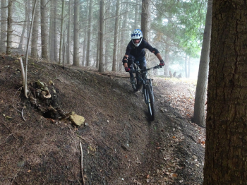
Itinerary in the middle Trebbia Valley starting from Bobbio in the province of Piacenza that concatenates 4 fun descents. The bottom is draining and is rideable provided at least 24 hours have passed since the last rains. The first ascent of about 1000 m of elevation gain is on asphalt with zero traffic and then on a dirt road with the last few meters pushed. This leads to the first descent: Sant'Agostino DH, very flowing with several curves and counter-gradient sections among conifer and beech forests.

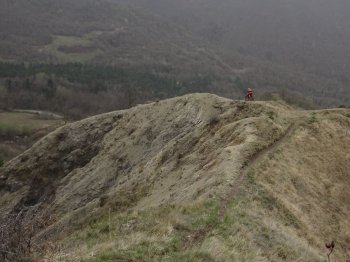
Very short stretch on asphalt and we are ready for the second descent: Lagon trail, very fun, also mostly in the woods. Another short transfer on asphalt to intercept the dirt road that with about 200 meters of elevation gain makes us regain altitude to take us to the beginning of the third trail: I Calanchi. The most scenic trail in the area, it passes over the ridges, slightly exposed but the trail presents no difficulty. When leaving the ridge there are short steeper sections.

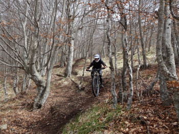
Yet another short transfer to the last descent that will take us to the valley: Costa del Cannone . Very long descent, all on single track, challenging enough. The track also includes the new variant. The descent ends in the Camping area, be careful on this last stretch as the bottom is less draining than the first part.
Full report

Download our free mobile app to send this route to your Garmin device or to navigate it on OSM maps. Android - iOS
Local weather
Tonight
6 °C
Tomorrow
11 °C
Tomorrow night
6 °C
Friday
10 °C
Friday night
2 °C
Saturday
8 °C
Saturday night
3 °C
Sunday
8 °C
Sunday night
6 °C
Monday
9 °C

Graph

Nearest Routes

2024/03/24
- Italy - Emilia-Romagna, PC
miciolo
(40)
34,59 km
Km
+1 453 mt
Vertical meters
Route difficulty
Landscapes
29,88 km
Km
+1 312 mt
Vertical meters
Route difficulty
Landscapes
2024/06/21
- Italy - Emilia-Romagna, PC
pozzoligio
(93)
30,92 km
Km
+1 400 mt
Vertical meters
Route difficulty
Landscapes
2022/11/03
- Italy - Emilia-Romagna, PC
pozzoligio
(93)
35,50 km
Km
+1 427 mt
Vertical meters
Route difficulty
Landscapes
2023/04/23
- Italy - Emilia-Romagna, PC
pozzoligio
(93)
39,99 km
Km
+1 530 mt
Vertical meters
Route difficulty
Landscapes
2023/03/17
- Italy - Emilia-Romagna, PC
pozzoligio
(93)
45,57 km
Km
+1 869 mt
Vertical meters
Route difficulty
Landscapes
2024/04/14
- Italy
pozzoligio
(93)
29,97 km
Km
+1 672 mt
Vertical meters
Route difficulty
Landscapes
2023/11/19
- Italy - Emilia-Romagna, PC
pozzoligio
(93)
51,66 km
Km
+1 450 mt
Vertical meters
Route difficulty
Landscapes
2023/11/28
- Italy - Emilia-Romagna, PC
miciolo
(40)
32,38 km
Km
+1 500 mt
Vertical meters
Route difficulty
Landscapes
2023/03/13
- Italy - Emilia-Romagna, PC
pozzoligio
(93)
66,61 km
Km
+2 450 mt
Vertical meters
Route difficulty
Landscapes

0 Comments