Italiano
 Deutsch
Calanchi di Fontana Marenga e Stampa (Val Trebbia)

The start of this route is from the convenient parking lot in the square in Marsaglia in the middle/high Trebbia Valley, a 50-minute drive from Piacenza. We start climbing on asphalt in the direction of Passo del Mercatello until we reach Casaldrino where a nice dirt road starts on the right that takes us to the Bazzini. Short stretch of asphalt and to the right starts a track on a wild path that runs alongside the road. We arrive at Castelcanafurone where at the first houses we turn sharp left onto a path that first gains height and then descends sharply until it intersects the road near Tortaro. Another short stretch on asphalt with zero traffic and on the left starts the dirt road that takes us above the village of Castelvetto.
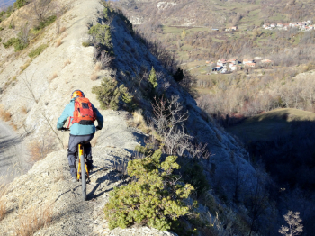
From Castelvetto, still on a nice dirt road, we reach Fontana Marenga and then the meadows below Monte Aserei. Now we put on the protections to descend into the scenic Calanchi where we need to be a bit careful on the first one as it is very steep. We descend to the Church of Barche and then with a short transfer we reach the village of Rosso. Upstream from the houses starts the trail with several push sections that with footbridges and overhanging sections leads to Metteglia. This section is not difficult but passes through places not very well traveled even by hikers and care must be taken as the downstream side is very steep.
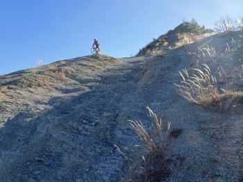
We pass between the houses of Metteglia, walk a few more hundred meters on comfortable dirt road and are ready to take the "La Stampa" trail. Trail that will take us down 700 meters of elevation gain where the endurance of bikers and vehicles will be put to the test. In this trail there is everything, many stretches on firm rock, on smosso, on dirt in the forest with quite a lot of leaf covering stones and channels caused by bikes and water. To do this trail you have to be nicely motivated and must like the genre, The risk is to get a lot of walking done.
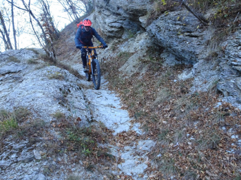
The trail is not as well-maintained as the trails you can find in nearby Bobbio. Arriving almost at the bottom you take the obvious mule track to the left while going to the right beautiful views of the Trebbia and the picturesque village of Brugnello. You skirt the stream and arrive at your cars in Marsaglia.