
 Italiano
 Deutsch
Monte Coltignone - sentiero della Dorsale

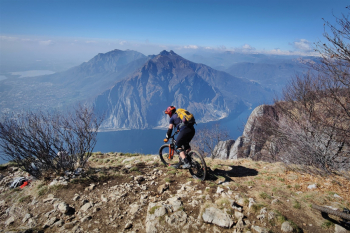
This loop tour passes through the foothills of the Grigne Mountains. From super-panoramic points and a nice hammering technical but never impossible descent.( If you want you can also descend from a less technical path on this track). Start from Abbadia Lariana and after 3 obligatory "adrenaline" kilometers on the Lariana freeway we descend on the lakeside bike path and then ride comfortably to the Resinelli foothills. The climb diverts in part to less busy trails. Wanting to avoid the freeway instead of climbing from Lecco, it is possible by Emtb to climb directly from Abbadia Lariana, by a very challenging mule track with killer gradients.
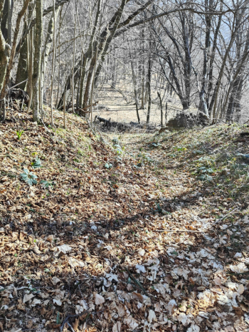
From Resinelli (the only water point) you pass by Parco Valentino on a pedalable forest trail until 50 meters from Coltigone where the trail becomes not very pedalable. We retrace our steps and then detour to the Belvedere Balcony, an artificial structure overhanging the lake to make your legs tighten.
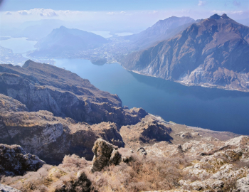
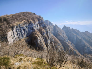
We follow the trail on a steep free ride descent with no particular technical steps to reach the Forcellino (another megapanoramic point). We turn back a few meters to enter the Grigne high route, after a short section on a scree S4 avoidable by passing more to the right the descent (very nice) continues medium S3 with a few S2 sections, on a very rocky and very pounding bottom sometimes stony but always enjoyable.
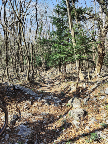
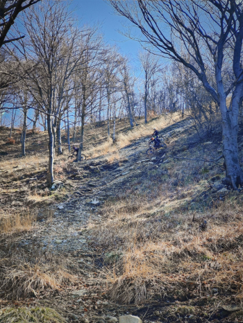
We ascend on challenging mule track for about 40 meters, then divert to a short S3 descent very rocky in steps that then becomes a nice fast S2 with a couple of technical S3 passages. We ascend back to Monte Borbino and then descend on a short and nice S2+ descent.
Notes: unlike what was reported in the old online trails, the trail has no exposed sections (I think it has been fixed).
Trail style: AM
Personal rating: views 9/10; Descents 8/10
MTB: yes
EMTB: yes
Duration about 4.5h (in Emtb)
Portage: about 20/30m push
Difficulty ascent: very comfortable
Difficulty descent: S3 with S4 passages
Exposed: NO
Drainage: exposed southwest, rocky bottom, I think so


