Italiano
 Deutsch
Fonte Solforosa Croce di Castel Gelato, CAI 547

Adventure-flavored itinerary for a second part definitely off the beaten path. Leaving Ronta we head towards the Passo della Colla on an accommodating asphalt climb. When we reach the pass we turn right, following the signs for Palazzuolo sul Senio. Arriving near Prato all'Albero we finally abandon the asphalt to enter the beautiful woods on a beautiful forest road until we cross CAI 505 that we follow for a few dozen meters and then change in favor of CAI 547, a few more strokes of the pedals and we reach the apex of the climb,where we stop to prepare for the descent.
The trail today is perfect and even though I have already done it more than once it always leaves you satisfied with the variety of situations you face. We come out on the road just before Crespino sul Lamone and having removed the protections we go up again towards La Colla. When we get to Casaglia instead of continuing to La Colla we climb up toward the village for a short off-trail. From the town we take CAI 551A, which on a steep slope and on a rocky surface rejoins 547 from where we passed just before. Just below the marking of the two trails we follow another unmarked but clearly visible trail that proceeds at high altitude in the beautiful pine forest-very narrow but cyclable.
When we begin to descend the trail is found to be a real treat with 3/4 very narrow switchbacks and although short very worthwhile also because at the end we find ourselves at the Sulphur Spring. Back on the Provinciale della Colla we resume the climb passing through the pass and reach for the second time Prato all'Albero where near the bend we take a not very visible path and then continue on the road that leads to the Valdiccioli bivouac. From here we have two solutions: the first follow the path that follows the Farfareta stream, which I already know, or a second by way of the ridge that I have never done. Intrigued by the novelty of course I opt for the second one following the Cai indicating Razzuolo.
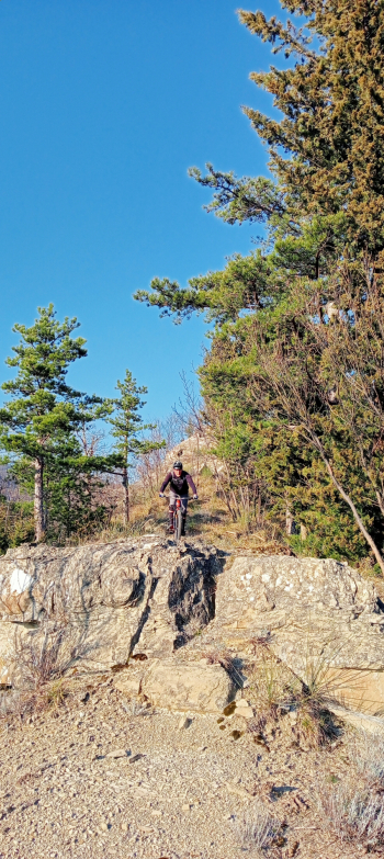
Initially the trail is fairly easy and cyclable, caught up in the excitement I take a series of switchbacks but quickly realize that it is not the trail I set out to follow. I turn back with regret because the trail was really inviting, and return to the point where I should have turned to continue the ridge. Effectively the detour is not well seen also because it remains higher than the Cai trail. Having resumed the Crinale route for a stretch we continue an alternating up and down on a trail that is always easy.
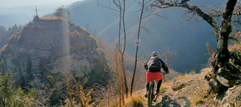
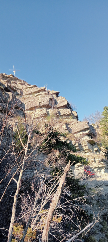
Things change drastically when the ridge begins to descend near Castel Gelato with important rock jumps that also oblige us to some passamano. We go around this small peak on very exposed and slippery trail and except for a few hard passes to try for the photo of the day the plot remains the same.
As we get closer to the road the trail mellows out and although it remains steep and dirty but allows us to get back in the saddle for the last 5/600 meters. That said surely this last part is not to be repeated except on foot,and fall back on the first alternative described above.
There certainly remains the beautiful experience of adventure,to which I am accustomed,and the beautiful environment crossed
.