
 Italiano
 Deutsch
Lozzole freeride e Scale dei Prati piani

Climb up towards Sambuca Pass, arrived near the Cross turn left on GEA with MTB freeride sign. Arrived at Ronchi di Berna Pass we walk a few more tens of meters to start the first descent on the Cai 505 trail to the village of Lozzole.
The descent begins in the woods and then continues in the beautiful ridge section to the Casté bivouac and then re-enters the woods and ends in front of the church of Lozzole. In the small village if you are lucky you will find the open bivouac and the small club where leaving a free offer you will find drinks and some snacks.
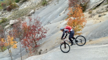
We continue the freeride itinerary uphill in characteristic and suggestive environments always on the Cai 505 trail to Mount Prevaligo where we resume the descent on the CAI 685 trail to Palazzuolo passing by the remains of the Castellaccio. From the village we leave for the second ascent on Via Faggiola to the Paretaio pass where we take CAI path 701. Arriving just below the top of Mount Faggiola we turn right onto CAI trail 609, which we will not leave until the end.
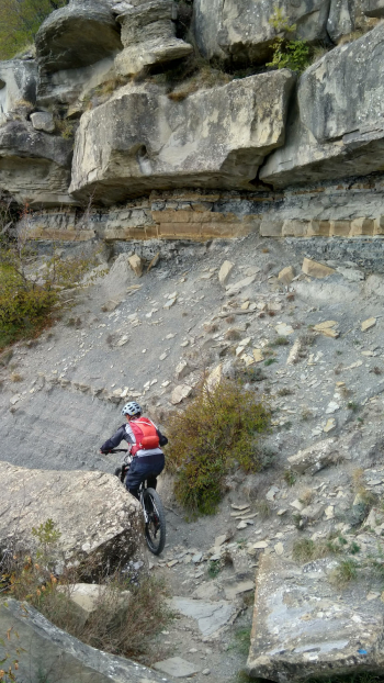
The first part of the trail is a nice single track in the woods alternated with a few relaunches that ends when we arrive at the Flat Meadows Stairs, a real must for technical lovers.
The section is short but very tough and except for one passage with drop really too much to the limit we manage to do it all in the saddle studying the various passages. When we arrive on the Prati Piani turning our backs it makes an impression to think that we have descended from there. The rest of the trail still alternates a few hard passes but compared to the Stairs it all seems more "normal".
Performed on 10/24/22


