Italiano
 Deutsch
Monte Orsa + Monte San Giorgio easy
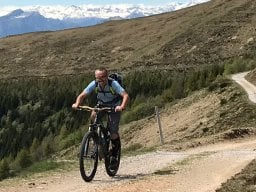
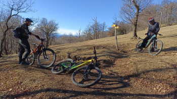
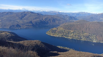
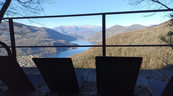
Italian-Swiss itinerary between Monte Orsa and Monte San Giorgio where the most challenging part, even technically, are the climbs. We start from Cantello cemetery with ample parking spaces, we reach the small church of Mount Sant'Elia in Viggiù almost completely on asphalt with a short stretch of busy road; with a short path we reach the Bernasca dirt road that climbs from Besano, now begins the first climb on the north side of Mount Orsa, which with some short but violent and rocky climbs (technical and not easy even with ebike), brings us to a border saddle under Mount Pravello. First part of the descent on mule track with some somewhat rocky passages until we reach a fork where we turn right on dry relaunching (small indication camping Monte San Giorgio ). We are in the valley of Meride, starts a very fun singletrack flow with some steep raises, nothing technically difficult, ending on the road almost in Arzo. Short asphalt road to the beautiful village of Meride where the very hard climb to San Giorgio begins, which in 3 km dirt road leads from the 580 meters of the village to the 1080 of the summit, where the views make you forget the effort. On the summit there is a small bivouac with drinks and possibility to pay electronically as well.
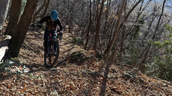
Now we descend on the splendid ridge trail until we veer to the left along a nice traverse (only one walkway near a stream where we can see a remnant of a collapsed bridge) to cross the climb at the St. Hubert refuge locality, still a very enjoyable traverse (with a log to climb over) to the flow descent to the Crocifisso locality. We return to Italy going to take the always beautiful fossil path that, with a few barely technical (max S2) passages, will end our descent to Besano. From here by mixed asphalt and dirt road we return to the car.
Recommended to ride with dry ground due to the presence of passages on rocks and roots, not difficult but potentially very slippery with wet.
Traveled on 4/1/24 with emtb