
 Italiano
 Deutsch
Monte Colombina - Valle dei Matti

Wanting to link the mythical descent from Malgalonga down to Sovere I tried a descent different from the usual Colombina descent coming down from the Matti valley, I anticipate that it is not a very exciting descent because of the high grass and the passage of motorcycles, at least the descent from Malgalonga makes you forget everything. Tour then divided into 2 tracks for convenience by about 1100 meters of elevation gain each, more easily modified
PART 1 COLOMBINA
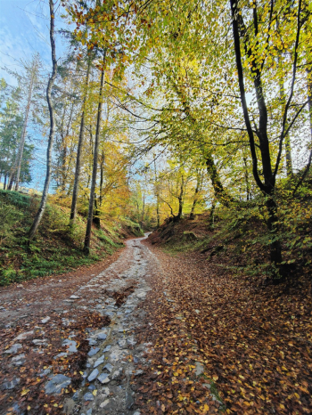
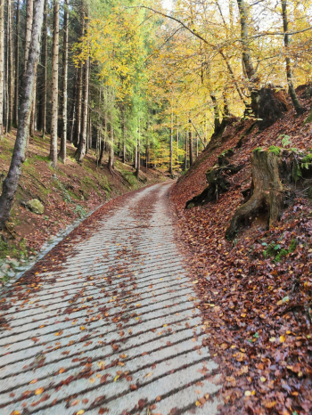
Ascent to Bossico on asphalt with comfortable gradients. Arrived in Bossico after ave passed the village, the offroad climb begins, the beautiful environment and autumn colors accompany often challenging gradients but on a beaten or cemented surface in the steepest sections however manageable even on mtb.
At the junction with where you turn left the music changes further and forces the mtb to push for cira 150 meters to the Bossico dropout, here the some passages force short pushes even the emtb. The ascent to Mount Colombina of the trail obliges 30 minutes with push bikes (personally I preferred to zig zag up the prairie with walk mode). Alternatively it is possible to climb from the north which should be more rideable.
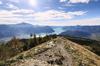
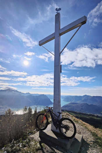
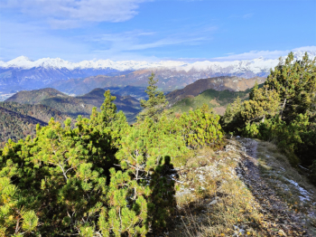
When we reach the top a huge cross awaits us and a panorama with breathtaking Lake Iseo views. The actual summit is further on and indicated by some flags. The descent of this trail is a vertical S3- and retraces the ascent, alternatively you can descend from the easier north.
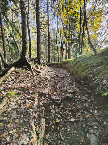
The trail continues with a nice traverse and then on several cart tracks to the first trail and several small descents, the first descent is a nice S3- the next a S2 but less accessible because of the passage of several bikes.
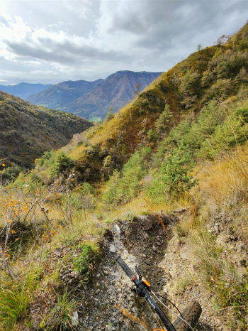
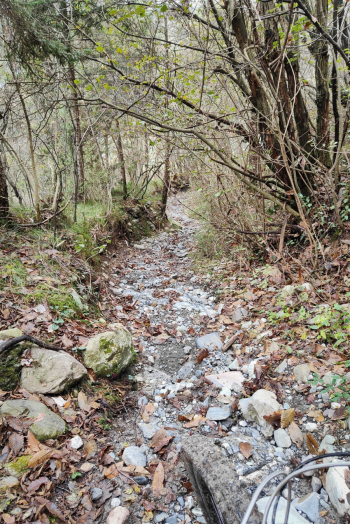
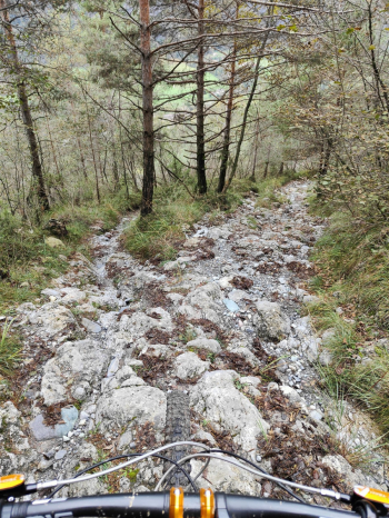
Now we will take the star descent of this trail, which, as I said, did not excite me. It is an S2 single track almost all rideable, (maybe a few S3 passes but not much) not very enjoyable because of the tall grass and in particular ruined in many places because of the passage of motorcycles. The track always keeps quite far from the edge which in some places is exposed (be careful) At the junction at an altitude of 600 meters turn right, the track widens but the music does not change much.
MTB: Yes
EMTB: Yes
Difficulty uphill: Very challenging final section, but little stuff overall.
Difficulty descent: S2+ some S3 sections.
Drainage: yes.


