
 Italiano
 Deutsch
Bienno, Monte Dasdana e Monte Crestoso
Long, beautiful, fun allmountain, cyclo-mountaineering, wide-open route in the Brescian pre-Alps straddling the Three Valleys. Very pedaled with two half hours of backpacking. Very open suggestive and wild environment. Two peaks are reached but it is possible to avoid them or climb others (Auccia, Colombine). Endless, often physical descent with some truly amazing sections.
Ascent
It starts in Bienno, Val Camonica, at 400 meters above sea level. Passing through one of the most beautiful villages in talia, where water is the main theme, we reach Prestine. Above the tiny village we first take a small dirt road and then a nice path, all comfortably rideable that makes us avoid a good bit of bitumen. Having inevitably reached the Crocedomini road, we pass the village of Degna. At the first hairpin bend, we will have to decide whether to take the dirt road and face a series of very steep ramps or given the very long climb continue more gently on the boring asphalt until the 1400 meters of the hamlet of Campolaro.
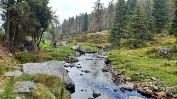
After a coffee stop we take a small road to the right and head in the direction of the enchanted Val Arcina, furrowed by a pretty stream and covered by an enchanted forest (it's just a pity that in the initial stretch the bottom was unnecessarily paved).
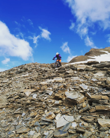
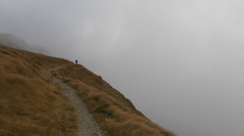
After about 25 km of ascent we reach the road coming from the Crocedomini Pass and heading to Maniva. Turning right we climb to Crapa de Vaia and Colle dei Setteventi. Here, if you wish, it is possible, passing by the Giogo de la Bala, to climb the Cima Auccia. Our track, however, continues on the road. Arriving at Dasdana Pass, 2080 meters, bike on our shoulders, climbing the ridge the eastern ridge, in half an hour we gain the summit of Dasdana, 2193 meters.
Enjoying the wide panorama we descend from the opposite ridge to a hill. Here it is possible to walk the entire ridge passing the top of all four Columbines (the first part of the descent from the third one is rather difficult but worth it), or follow the track to the left and descend to the ruin of the so-called barracks. Following the dirt road halfway up and then, from the Goletto di Cludona, a beautiful trail, we arrive at the characteristic Seven Crosses Pass, 2041 meters.
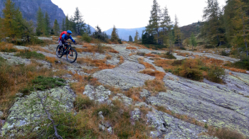
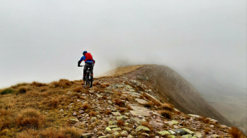
We continue further in the direction of the pass and Mount Crestoso. At the fork we take the ridge and following the white-blue trail marker we reach the summit of Crestoso , 2209 meters. One more stretch of flat ridge and we are at the beginning of the descent.
Descent
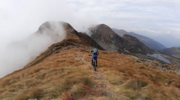
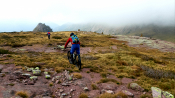
We descend along the rocky and scenic western ridge to the first saddle, to the right a trail descends in the direction of the S. Glisente Niche. After a scurvy first section (a few steps on foot), the descent follows cairns on spectacular red rock slabs, the wild setting is very impressive. Crossing a nice path we turn right and follow it to the pass of the Niche of St. Glisente, 1980 meters.
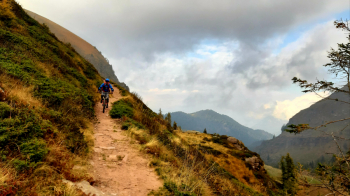
Here begins the descent into the lonely and beautiful Val Gabbia. The first part is fairly smooth up to the hut and beyond. Then you cross rocky sections with several raises. There are characteristic and spectacular rocky slabs on the side of the rocky trail then other really nice sections. At an elevation of 1540, near a hut, the trail turns right and enters the woods with some libidinous rocky passages, then more rocks and roots until we reach the Campolungo horizontal trail. We follow it to the right for a stretch to the beginning of the trail that descends to Ponte de Berto (this steep section is getting a bit ruined by the passage of motorcycles unfortunately, and I wonder how it is possible to allow motorcyclists to ride and ruin mountain trails).
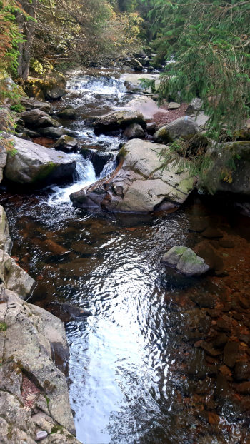
Beyond the bridge we climb a few meters and then descend again until we reach the Val Grigna forest road. Now we follow the small road to the left, first flat and slightly uphill, then downhill for a stretch until just before the village of Nessalveno. At an altitude of 850 meters we take a path marked by green arrows on the right. When the descent seems to be over, on a wide, gravel path, we have to be careful to spot on the right a last steep little path that shortly ends at a kiosk on the Grigna stream just outside the houses of Bienno. We enter the village to return to our starting point.


