2023/08/26 19:12:45
Stoneman giorno 2/2
Author
Place
Italy - Trentino-Alto Adige/Südtirol, BZ
Km
34,13 km
Elapsed time
03:52:37
Vertical meters
+1 290 mt (1197 - 2454)
Route difficulty
Landscapes
Last update
2023/08/27 08:49:16
Comments
Description
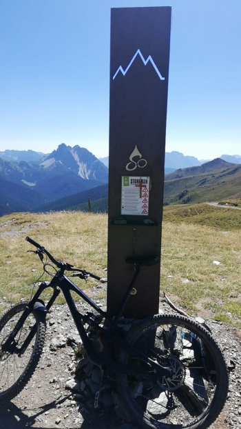
Second day of the Stoneman starting in Toblach(first day here). I chose to do the Marchkinkele ascent on the second day to have less elevation gain to complete.
The ascent is the classic one recommended on the Stoneman website, I changed the descent following the A1 trail to avoid going down the military road. The trail is well marked and has as its only difficulty some sections with loose stones, but it is never exposed and steep. The return to Toblach is then along the Valle di San Silvestro. You can refuel at the Marchhutte, the hut located at the summit of the Cornetto di Confine, there is a fountain outside one of the last hairpin bends and other fresh water options along the ascent.
This is the final milestone

Local weather

°C

°C

°C

°C

°C

°C
Graph
Nearest Routes
50,14 km
Km
+1 016 mt
Vertical meters
Route difficulty
Landscapes
48,67 km
Km
+213 mt
Vertical meters
Route difficulty
Landscapes
41,26 km
Km
+1 406 mt
Vertical meters
Route difficulty
Landscapes
77,84 km
Km
+2 510 mt
Vertical meters
Route difficulty
Landscapes
43,92 km
Km
+1 487 mt
Vertical meters
Route difficulty
Landscapes
51,40 km
Km
+1 210 mt
Vertical meters
Route difficulty
Landscapes
2023/03/05
- Italy - Trentino-Alto Adige/Südtirol, BZ 118,42 km
Km
+1 920 mt
Vertical meters
Route difficulty
Landscapes
2023/02/26
- Italy - Trentino-Alto Adige/Südtirol, BZ 34,09 km
Km
+1 420 mt
Vertical meters
Route difficulty
Landscapes
48,18 km
Km
+1 684 mt
Vertical meters
Route difficulty
Landscapes
48,18 km
Km
+1 500 mt
Vertical meters
Route difficulty
Landscapes


 Italiano
 Deutsch