HOME RANKINGS CHALLENGES ROUTES POI PLANNING SEARCH LOGIN
Italy - Trentino-Alto Adige/Südtirol, BZ
2023/02/25 14:56:57

Marchkinkele

5 Downloads
0
 
Author
Antosangui
(106)
Place
Italy - Trentino-Alto Adige/Südtirol, BZ
Km
41,26 km
Elapsed time
01:44:01
Vertical meters
+1 406 mt (1173 - 2529)
Route difficulty
Landscapes
Last update
2023/02/25 16:53:13
Comments
0
Description

This route leads up to the cornetto di confine/Marchkinkele and touches on a Stoneman point of interest.

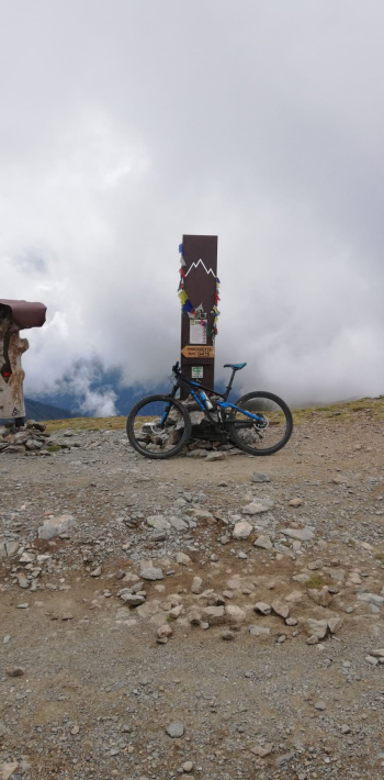
The trail starts in Toblach, you head on asphalt to the St. Sylvester Valley, at the first fork you go right to the St. Sylvester hut on a dirt road. Follow the main dirt road to the fork where you take a right and arrive at the hut, pass it and before reaching the parking lot take a sharp left and climb the dirt road that leads to the boundary cornetto, always staying on the main dirt road. As you climb in elevation, the vegetation thins out and the view of the Pustertal valley opens up. After a substantial number of hairpin bends you finally reach the Church Mount where the Stoneman's memorial stone is located; a photo is mandatory.

You walk the last few hundred meters and before the ramp that leads to the hut you take the path that goes first to the Steinbergalm and then back to the St. Sylvester hut, however, you come to the parking lot where you take a left downhill, at the next fork you keep right while at the one after that you keep left. You thus come to the end of the dirt road and join the asphalt at a hairpin bend, where you go left downhill. At the next hairpin bend you leave the main road and follow the signs for Gassler. At the end of the asphalt you take the dirt road to the left, which after a while leads to a fork, where you take a right. The dirt road then comes out at a hairpin bend on asphalt where you take a left and continue downhill until you cross the Drava bike path that allows you to return to Toblach.

The route is difficult as you reach more than 2500 m and the ascent is long, the downhill part presents a first piece of alpine single track with no particular difficulty and the second part on dirt road, has no exposed parts.

Download our free mobile app to send this route to your Garmin device or to navigate it on OSM maps. Android - iOS

Graph

Nearest Routes

2023/08/26
- Italy - Trentino-Alto Adige/Südtirol, BZ
Antosangui
(106)
77,84 km
Km
+2 510 mt
Vertical meters
Route difficulty
Landscapes
2023/08/26
- Italy - Trentino-Alto Adige/Südtirol, BZ
Antosangui
(106)
34,13 km
Km
+1 290 mt
Vertical meters
Route difficulty
Landscapes
2023/03/02
- Italy - Trentino-Alto Adige/Südtirol, BZ
Antosangui
(106)
50,14 km
Km
+1 016 mt
Vertical meters
Route difficulty
Landscapes
2023/03/02
- Italy - Trentino-Alto Adige/Südtirol, BZ
Antosangui
(106)
48,67 km
Km
+213 mt
Vertical meters
Route difficulty
Landscapes
2023/02/25
- Italy - Trentino-Alto Adige/Südtirol, BZ
Antosangui
(106)
43,92 km
Km
+1 487 mt
Vertical meters
Route difficulty
Landscapes
2023/03/05
- Italy - Trentino-Alto Adige/Südtirol, BZ
nonnocarb
(266)
51,40 km
Km
+1 210 mt
Vertical meters
Route difficulty
Landscapes
2023/03/05
- Italy - Trentino-Alto Adige/Südtirol, BZ
nonnocarb
(266)
118,42 km
Km
+1 920 mt
Vertical meters
Route difficulty
Landscapes
2023/02/26
- Italy - Trentino-Alto Adige/Südtirol, BZ
nonnocarb
(266)
34,09 km
Km
+1 420 mt
Vertical meters
Route difficulty
Landscapes
2022/10/28
- Italy - Trentino-Alto Adige/Südtirol, BZ
nonnocarb
(266)
48,18 km
Km
+1 684 mt
Vertical meters
Route difficulty
Landscapes
2023/03/01
- Italy - Trentino-Alto Adige/Südtirol, BZ
nonnocarb
(266)
48,18 km
Km
+1 500 mt
Vertical meters
Route difficulty
Landscapes

0 Comments