HOME RANKINGS CHALLENGES ROUTES POI PLANNING SEARCH LOGIN
Italy - Trentino-Alto Adige/Südtirol, BZ
2023/03/02 11:10:38

Prato Piazza e malga Stolla

3 Downloads
0
 
Author
Antosangui
(106)
Place
Italy - Trentino-Alto Adige/Südtirol, BZ
Km
50,14 km
Elapsed time
04:33:33
Vertical meters
+1 016 mt (1127 - 2015)
Route difficulty
Landscapes
Last update
2023/03/02 12:15:28
Comments
0
Description

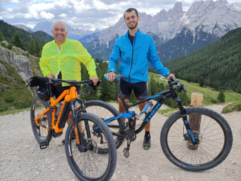
Departing from Dobbiaco, follow the bike path to Cortina and once in Carbonin take the climb to Prato Piazza, a climb that is part of the Dolomiti Superbike route, it is tackled uphill or downhill depending on the year. The climb proceeds on a dirt road to Rifugio Vallandro, which is on the right, a good spot to refuel or get something to eat. The view is worth it, you can see the Sexten Dolomites in front of us.


Unfortunately the Garmin has chocolated me for a moment and the track has a whisker in this part, however we proceed to the Prato Piazza hut and here we take a left downhill in the middle of the meadow, very nice trail. This brings you to Malga Stolla, take the dirt road downhill and then follow the trail to the left. Very nice and easy path that returns to the dirt road, cross a stream and take the path again on the left. Watch out for intersections with the asphalt road going up to Prato Piazza. Once on asphalt, take a fun single track to the left that runs alongside the road. This will take you to the road to Lake Braies, which you can reach by going left, while if you go right you will return to Villabassa, back to Toblach via the convenient Pustertal bike path.


Download our free mobile app to send this route to your Garmin device or to navigate it on OSM maps. Android - iOS

Graph

Nearest Routes

2023/03/02
- Italy - Trentino-Alto Adige/Südtirol, BZ
Antosangui
(106)
48,67 km
Km
+213 mt
Vertical meters
Route difficulty
Landscapes
2023/08/26
- Italy - Trentino-Alto Adige/Südtirol, BZ
Antosangui
(106)
34,13 km
Km
+1 290 mt
Vertical meters
Route difficulty
Landscapes
2023/02/25
- Italy - Trentino-Alto Adige/Südtirol, BZ
Antosangui
(106)
41,26 km
Km
+1 406 mt
Vertical meters
Route difficulty
Landscapes
2023/08/26
- Italy - Trentino-Alto Adige/Südtirol, BZ
Antosangui
(106)
77,84 km
Km
+2 510 mt
Vertical meters
Route difficulty
Landscapes
2023/02/25
- Italy - Trentino-Alto Adige/Südtirol, BZ
Antosangui
(106)
43,92 km
Km
+1 487 mt
Vertical meters
Route difficulty
Landscapes
2023/03/05
- Italy - Trentino-Alto Adige/Südtirol, BZ
nonnocarb
(266)
51,40 km
Km
+1 210 mt
Vertical meters
Route difficulty
Landscapes
2023/03/05
- Italy - Trentino-Alto Adige/Südtirol, BZ
nonnocarb
(266)
118,42 km
Km
+1 920 mt
Vertical meters
Route difficulty
Landscapes
2023/02/26
- Italy - Trentino-Alto Adige/Südtirol, BZ
nonnocarb
(266)
34,09 km
Km
+1 420 mt
Vertical meters
Route difficulty
Landscapes
2022/10/28
- Italy - Trentino-Alto Adige/Südtirol, BZ
nonnocarb
(266)
48,18 km
Km
+1 684 mt
Vertical meters
Route difficulty
Landscapes
2023/03/01
- Italy - Trentino-Alto Adige/Südtirol, BZ
nonnocarb
(266)
48,18 km
Km
+1 500 mt
Vertical meters
Route difficulty
Landscapes

0 Comments