2023/03/07 22:45:37
Sentieri da Laces a Cengles
Author
Place
Italy - Trentino-Alto Adige/Südtirol, BZ
Km
51,34 km
Elapsed time
05:25:04
Vertical meters
+980 mt (641 - 1110)
Route difficulty
Landscapes
Last update
2023/03/09 17:00:44
Comments
Description
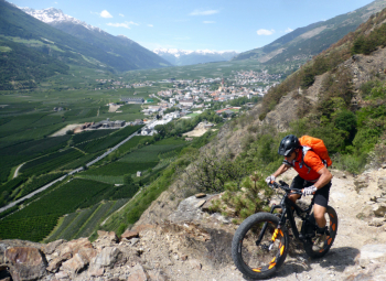
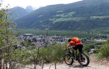
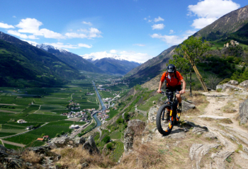
Very enjoyable route that follows many paths on either side of the Adige Valley.

From Laces you climb the Waalweg south of the town, then cross the Martello valley and continue on the opposite side. Continue along the edge of the forest all the way to Cengles, with some sections on the road. From Cengles you cross to the opposite side of the valley and return to Silandro.

Here some pushing sections and then more trail at the edge of the forest, always up and down, to Laces. Challenging route, you also need to have good riding technique on the narrow trails

Local weather
Today

23 °C
Tonight

16 °C
Tomorrow

20 °C
Tomorrow night

12 °C
Wednesday

25 °C
Wednesday night

15 °C
Graph
Nearest Routes
26,12 km
Km
+1 250 mt
Vertical meters
Route difficulty
Landscapes
72,93 km
Km
+2 970 mt
Vertical meters
Route difficulty
Landscapes
32,13 km
Km
+2 033 mt
Vertical meters
Route difficulty
Landscapes
37,04 km
Km
+1 770 mt
Vertical meters
Route difficulty
Landscapes
2024/01/10
- Italy - Trentino-Alto Adige/Südtirol, BZ 27,47 km
Km
+1 500 mt
Vertical meters
Route difficulty
Landscapes
2023/07/26
- Italy - Trentino-Alto Adige/Südtirol, BZ 28,35 km
Km
+1 500 mt
Vertical meters
Route difficulty
Landscapes
2023/06/01
- Italy - Trentino-Alto Adige/Südtirol, BZ 31,15 km
Km
+1 173 mt
Vertical meters
Route difficulty
Landscapes
2024/10/29
- Italy - Trentino-Alto Adige/Südtirol, BZ 35,52 km
Km
+1 400 mt
Vertical meters
Route difficulty
Landscapes
30,40 km
Km
+1 865 mt
Vertical meters
Route difficulty
Landscapes
2025/08/12
- Italy - Trentino-Alto Adige/Südtirol, BZ 43,72 km
Km
+2 550 mt
Vertical meters
Route difficulty
Landscapes


 Italiano
 Deutsch