HOME RANKINGS CHALLENGES ROUTES POI PLANNING SEARCH LOGIN
Italy - Trentino-Alto Adige/Südtirol, TN
2023/03/06 21:05:57

Cresta dell'Aut

24 Downloads
0
 
Share
Author
nonnocarb
(292)
Place
Italy - Trentino-Alto Adige/Südtirol, TN
Km
20,80 km
Elapsed time
04:38:20
Vertical meters
+1 120 mt (1329 - 2464)
Route difficulty
Landscapes
Last update
2023/03/07 14:22:05
Comments
1
Description

Very short route as kilometers, but very very challenging, both for the very hard climb and the very technical descent. On the other hand, the views are exceptional over the Dolomites.
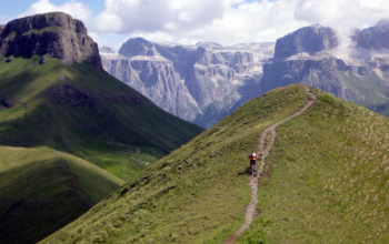
From Mazzin you descend on the bike path, after the bridge to Pera di Fassa you turn left and climb following val Giumela. Initially rideable, the forest road continues with some cemented sections with terrible gradient, you can do them in the saddle but you need a leg of steel!
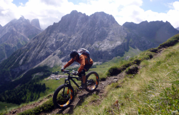
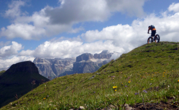
At the Giumela alpine hut a little rest, but we immediately start again on the steep! Then more steep and more rideable sections until Brunech saddle 2428m. Now a beve stretch of back-biking to Aut, 2480 with fantastic 360° views of the Dolomites. From here you descend on the ridge, challenging but very beautiful with Crespa Neigra in front, until you meet the junction with the 645. You go down with technical sections until the beginning of the forest, but the most challenging part starts now, very difficult sections, but very fun if you have the right bike and a good technique until Fontanazzo, then back on bike path.

Reserved for very trained and very experienced bikers
Download our free mobile app to send this route to your Garmin device or to navigate it on OSM maps. Android - iOS
Local weather
Today
-1 °C
Tonight
-7 °C
Tomorrow
4 °C
Tomorrow night
-3 °C
Monday
5 °C
Monday night
1 °C
Tuesday
4 °C
Tuesday night
-2 °C
Wednesday
4 °C
Wednesday night
-2 °C

Graph

Nearest Routes

2022/08/19
- Italy - Trentino-Alto Adige/Südtirol, TN
pozzoligio
(93)
51,42 km
Km
+2 048 mt
Vertical meters
Route difficulty
Landscapes
2022/08/20
- Italy - Trentino-Alto Adige/Südtirol, TN
pozzoligio
(93)
28,10 km
Km
+791 mt
Vertical meters
Route difficulty
Landscapes
2022/10/22
- Italy - Trentino-Alto Adige/Südtirol, TN
nonnocarb
(292)
41,88 km
Km
+2 190 mt
Vertical meters
Route difficulty
Landscapes
2023/02/26
- Italy - Trentino-Alto Adige/Südtirol, TN
nonnocarb
(292)
24,50 km
Km
+1 500 mt
Vertical meters
Route difficulty
Landscapes
2023/07/28
- Italy - Trentino-Alto Adige/Südtirol, TN
pozzoligio
(93)
35,59 km
Km
+1 551 mt
Vertical meters
Route difficulty
Landscapes
2023/07/27
- Italy - Trentino-Alto Adige/Südtirol, TN
pozzoligio
(93)
47,84 km
Km
+2 292 mt
Vertical meters
Route difficulty
Landscapes
2023/07/25
- Italy - Trentino-Alto Adige/Südtirol, TN
pozzoligio
(93)
64,76 km
Km
+2 100 mt
Vertical meters
Route difficulty
Landscapes
2023/07/25
- Italy - Trentino-Alto Adige/Südtirol, TN
pozzoligio
(93)
55,87 km
Km
+1 637 mt
Vertical meters
Route difficulty
Landscapes
2024/07/30
- Italy - Trentino-Alto Adige/Südtirol, TN
Staff
(77)
32,71 km
Km
+1 088 mt
Vertical meters
Route difficulty
Landscapes
2024/07/12
- Italy - Trentino-Alto Adige/Südtirol, TN
31,65 km
Km
+1 250 mt
Vertical meters
Route difficulty
Landscapes

1 Comments