2023/03/06 20:28:11
Lago Santo da Salorno
Author
Place
Italy - Trentino-Alto Adige/Südtirol, BZ
Km
34,31 km
Elapsed time
04:59:01
Vertical meters
+1 100 mt (203 - 1294)
Route difficulty
Landscapes
Last update
2023/03/07 11:53:14
Comments
Description
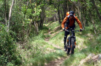
Challenging route because of the long and in places steep ascent and the path down to the valley.

From Laghetti you arrive in Salorno and from here you climb at first very hard and then on a somewhat more rideable ascent to the Sauch hut. From here you climb again to Holy Lake, with refreshments and a nice view of the lake. Take the trail and forestry road to Cauria with panoramic views, then turn off onto the forestry road that descends and follow the lsentiero that cuts hairpin bends, fairly smooth with technical sections. When you reach the road, continue right toward Laghetti. Arriving almost in the village, su can make one more detour on the Dürer trail and then return toward the parking lot.
Local weather
Oggi

24 °C
Stasera

13 °C
Domani

27 °C
Domani sera

16 °C
lunedì

27 °C
Lunedì notte

17 °C
Graph
Nearest Routes
28,26 km
Km
+1 600 mt
Vertical meters
Route difficulty
Landscapes
19,93 km
Km
+1 100 mt
Vertical meters
Route difficulty
Landscapes
24,25 km
Km
+1 389 mt
Vertical meters
Route difficulty
Landscapes
36,90 km
Km
+1 604 mt
Vertical meters
Route difficulty
Landscapes
30,38 km
Km
+1 600 mt
Vertical meters
Route difficulty
Landscapes
21,53 km
Km
+1 150 mt
Vertical meters
Route difficulty
Landscapes
50,17 km
Km
+1 000 mt
Vertical meters
Route difficulty
Landscapes
17,79 km
Km
+929 mt
Vertical meters
Route difficulty
Landscapes
17,43 km
Km
+751 mt
Vertical meters
Route difficulty
Landscapes
38,08 km
Km
+1 272 mt
Vertical meters
Route difficulty
Landscapes


 Italiano
 Deutsch
