2023/03/05 23:40:20
Cima Trumes
Author
Place
Italy - Trentino-Alto Adige/Südtirol, BZ
Km
64,24 km
Elapsed time
10:38:06
Vertical meters
+2 500 mt (213 - 2914)
Route difficulty
Landscapes
Last update
2023/03/06 08:31:11
Comments
Description
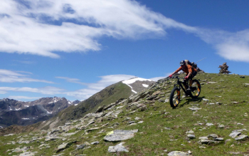
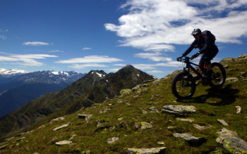
Very long and tiring route, but also very scenic and fun.

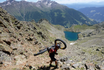
We started from Merano, but if you want to shorten the tour just start from the parking lot at the base of Val Senales. You go up to Certosa on asphalt (possibility of bus with bike transport). From here we climb by forestry to the Klosteralm (refreshment) and begin the section with bike on the back, up to the summit, of about 750 meters in altitude difference.

From the summit Trumes fantastic view of Schnals valley and Vinschgau. Now a very long descent, with technical sections, to the village of Monte trumes. Then turn left and descend on the challenging but very fun trail 2 to Ciardes. You return to the start on bike path.

Local weather
Today

24 °C
Tonight

16 °C
Tomorrow

22 °C
Tomorrow night

12 °C
Wednesday

26 °C
Wednesday night

15 °C
Graph
Nearest Routes
86,52 km
Km
+3 200 mt
Vertical meters
Route difficulty
Landscapes
86,32 km
Km
+2 856 mt
Vertical meters
Route difficulty
Landscapes
2024/10/29
- Italy - Trentino-Alto Adige/Südtirol, BZ 52,33 km
Km
+2 300 mt
Vertical meters
Route difficulty
Landscapes
90,75 km
Km
+1 510 mt
Vertical meters
Route difficulty
Landscapes
36,78 km
Km
+1 610 mt
Vertical meters
Route difficulty
Landscapes
67,38 km
Km
+1 900 mt
Vertical meters
Route difficulty
Landscapes
65,56 km
Km
+2 000 mt
Vertical meters
Route difficulty
Landscapes
2023/03/01
- Italy - Trentino-Alto Adige/Südtirol, BZ 49,83 km
Km
+950 mt
Vertical meters
Route difficulty
Landscapes
32,17 km
Km
+1 852 mt
Vertical meters
Route difficulty
Landscapes
32,34 km
Km
+1 500 mt
Vertical meters
Route difficulty
Landscapes


 Italiano
 Deutsch